概要信息:
transportation plan
parkmerced
DRAFT
   10.14.10
The Parkmerced Transportation Plan establishes specific goals, strategies and targets that will be incorporated
into the transformation of Parkmerced into a model 21st century neighborhood.  The Plan provides a framework
and management plan for addressing transit and vehicular travel to and from the neighborhood.  Together
with the accompanying Vision Plan, Design Standards and Guidelines, Sustainability Plan, and Infrastructure
Report, the Parkmerced Transportation Plan provides a comprehensive vision for all future improvements at
Parkmerced.
-  The Vision Plan lays out the vision and conceptual frameworks for all proposed improvements at Parkmerced.
-  The Design Standards and Guidelines prescribe urban design controls for land use, open spaces, streets,
blocks  and individual buildings.  It also outlines a process for project implementation.
- The Sustainability Plan contains specific strategies and metrics which together address the management
and conservation of energy, water and other natural resources, as well as establish goals for green building
standards.
- The Infrastructure Report establishes an outline for anticipated site-wide improvements to all streets and
public rights-of-way, underground utilities, and grading.
The vision has been developed through a collaborative process with input from community members, local agen-
cies and departments, public advocacy organizations and design and engineering experts.
DRAFT
parkmerced vision plan
transportation plan
01
02
03
04
05
06
Introduction	 	 	 	 									4
Challenges and Implementation           6
Principles             6
Goals                6
Strategies             6
Existing	Transportation	Conditions	 									8
Existing Street Network         11
Existing Transit Services         12
Existing Bicycle and Pedestrian Network       13
Existing Parking          15
Existing Travel Characteristics        15
Existing Circulation and Access Issues       16
Proposed	Development	and	Infrastructure	 						18
Land Use Program         20
Internal Street Network         22
External Intersection and
Roadway Improvements         28
Transit Modifications
Pedestrian and Bicycle Circulation        32
Possible Long-Term Projects        33
Proposed	Transportation	Program	and	Policies		34
Strategies          36
Implementation	and	Phasing	 	 							52
Conclusion	 	 	 	 						54
DRAFT
4
Challenges and Implementation                6
Principles               6
Goals                  6
Stratgies               6
introduction
01
DRAFT
The Parkmerced Transportation Plan (herein referred to as the “Plan”) envisions the trans-
formation of the existing automobile-oriented community into an international example of
sustainable living.  Current levels of private vehicle use at Parkmerced are not sustainable;
as such, this Plan lays out a series of strategies that emphasize transportation alternatives.
The seamless integration of land use and transportation is a fundamental principle of the
proposed land use plan and urban form goals for Parkmerced.  The proposed neighbor-
hood design facilitates convenient access to all areas on foot, by bicycle, and via transit,
and is designed to reduce single-occupant auto trips.  The land use plan features a sus-
tainable and compact development pattern focused around a mixed-use center adjacent
to transit stations.
By providing a structure that allows for safe and convenient travel by non-automobile
modes, the paradigm of the overall neighborhood design can be shifted away from the
standard automobile-focus.  This can be achieved through the implementation of programs
to reduce the attractiveness of private automobile use, such as limits to off-street parking
and requiring market-rate parking costs.  In addition, to support this vision for Parkmerced,
dedicated policies and programs have been developed to promote the use of non-automo-
bile modes, thereby facilitating their use and attractiveness.
This document presents the goals, principles and strategies that have been developed
to facilitate the travel demand needs of an emerging mixed-use, urban eco-community
in southwest San Francisco.  Incorporating innovative practices and sustainable devel-
opment principles, this Plan will provide residents, employees and visitors with highest-
quality multimodal transportation infrastructure and services.
DRAFT
5
6   │ P A R K M E R C E D  T R A N S P O R T A T I O N  P L A N  /  1 0 . 1 4 . 1 0
introduction
Challenges and Implementation
The Plan recognizes the mobility challenges facing Park-
merced.  Originally designed as an automobile-oriented
community, the Plan envisions a greater role for transit,
bicycle and pedestrian travel.  The opportunity to access
services and conduct business within the larger commu-
nity that are currently unavailable within the neighborhood,
will be introduced.  Regional connections, now weak or
strained, will be facilitated and strengthened.
The Plan represents a significant investment in transporta-
tion on a scale not seen on the west side of San Francisco
in several decades.  Reflecting its impact and importance,
the Plan has been developed with the participation of
existing residents and neighboring communities, as well
as city, county and state agencies.  All programs and im-
provements detailed in the Plan will be implemented by
Parkmerced, and Parkmerced will be responsible for all re-
quired design, approval and construction activities, under
supervision and guidance from the appropriate city, county
and state agencies and departments.
The Plan also recognizes the close relationship between
land use and transportation, and embodies the Parkmerced
Vision Plan and Parkmerced Design Standards and Guide-
lines. The goals, principles and strategies in this Plan are
supported by a mixed-use development approach, as well
as an impressive investment in infrastructure and services.
Principles
- Transportation infrastructure will be designed around
walking and biking as primary modes, consistent with
the San Francisco Better Streets Plan;
- Automobile use will be discouraged through traffic calm-
ing, parking management, and access management
policies; and,
- Transportation demand measures will be implemented
to encourage transit, pedestrian and bicycle travel and
will be directed at residents, employees and visitors.
Goals
- Reduce the need for private vehicles for work and non-
work trips;
- Enhance the attractiveness and affordability of alterna-
tive modes of transportation;
- Internalize discretionary trips; and,
- Minimize increases in peak hour vehicle trips outside the site.
Strategies
The Parkmerced project aims to create a self-sufficient
community with a broad range of neighborhood-serving
services, and serve as a world-class model of sustainable
development and transportation. As a result, the future com-
munity design incorporates a development pattern centered
around a mixed-use core, with strong transit, bicycle and
pedestrian connections.
The Plan’s elements prioritize walking, bicycling and tran-
sit travel, making these attractive and practical transporta-
tion options, while discouraging private automobile trips.
These elements include the integration of land-use and
transportation, new and improved transit options, and re-
quired roadway improvements.
To support the proposed major infrastructure and develop-
ment, a series of programs and policies have also been
developed.  Implementation of these elements will be criti-
cal to the success of the Plan, as they provide the direction
and assistance for all travel modes, plus design require-
ments that reinforce the nature of the development.
It is acknowledged, however, that any development within
Parkmerced will continue to generate trips by private ve-
hicles, which will strain the local and regional facilities that
are already at or near capacity.  Therefore, improvements
to the surrounding intersections and roadways are includ-
ed as an integral component of the Plan.  These planned
improvements would be enhanced by a future, broader, re-
gional transportation solution to the area.  The Parkmerced
project (sponsors) will participate in any such area-wide
transportation planning effort.
The	following	are	the	key	strategies	of	the	plan:
- Components of the Plan will be implemented at the ear-
liest stages of development, and measures and servic-
es will be adopted concurrent with phasing;
- The internal street network has been designed to em-
phasize walking and bicycling and to reduce vehicular
speeds, providing a positive experience for non-auto-
mobile travel;
- The Muni M-Ocean View light rail line is proposed to be
rerouted directly through Parkmerced, with the provision
of one relocated station, two new stations, and no re-
duction in the number of existing stops serving adjacent
neighborhoods;
- Enhanced transit service to and from Parkmerced will
operate throughout the day, evening, and weekends to
provide convenient connections to employment activity
centers and the regional transit network;
- Pedestrian and bicycle facilities will be provided through-
out the site to facilitate walking and biking as modes of
travel for internal and external trips;
- Intersections and roadways on the outside of Park-
merced will be redesigned and improved to reduce con-
gestion and to increase mobility;
- Free, low-emission shuttles will be operated to the Bay
Area Rapid Transit (BART) Daly City station (hereinafter
referred to as the Daly City BART Station) and nearby
shopping centers;
DRAFT
│  7 1 0 . 1 4 . 1 0  /  P A R K M E R C E D  T R A N S P O R T A T I O N  P L A N
- A parking management plan will be implemented to increase the competi-
tiveness of transit and to manage demand throughout the neighborhood;
- Residential parking will be unbundled from individual units, with lower sup-
ply provided near transit stations and the mixed-use center, and higher sup-
ply provided at peripheral locations to maximize the use of “car storage”;
- Carshare vehicle hubs and bikeshare stations will be established at strategic
locations throughout the project site;
- A smart card will be introduced, allowing residents to pay for parking or ac-
cess bikeshare station bicycles using a single pay system; and,
- A full-time transportation coordinator will be employed to manage the real-
time transportation needs of residents.
The major elements of the Plan are highlighted in Figure	1.
As the overall Parkmerced project will evolve throughout its design, approval
and implementation process, it is anticipated that this Plan will be a living docu-
ment, in that the proposed infrastructure improvements, programs and policies
may need to be modified commensurate with any changes to the project.
The remainder of this document provides the detailed approach of the Plan
and is separated into the following sections:
- Chapter 2 presents the existing transportation conditions in and around
Parkmerced, including some of the current constraint and problem loca-
tions;
- Chapter 3 highlights the major development and infrastructure proposals;
- Chapter 4 develops the extensive programs and policies;
- Chapter 5 outlines the implementation and phasing strategies; and,
- Chapter 6 presents the Plan conclusions.
L A K E
M E R C E D
P I N E  L A K E  P A R K
H A R D I N G
P A R K
S A N  F R A N C I S C O
G O L F  C L U B
O L Y M P I C
C O U N T R Y  C L U B
L A K E  M E R C E D
G O L F  C L U B
1
9
t
h
 A
v
e
.
L a k e s h o r e
P l a z a
S h o p p i n g
C e n t e r
S l o a t  B l v d .
P
o
r t o
l a
 D
r .
O c e a n  A v e .
S
u
n
s
e
t
 B
lv
d
.
W
i n
s t o
n
 D
r .
L
a
k
e
 M
e
r
c
e
d
 B
lv
d
.
J o h n  M
u i r  D
r .
J o h n  D a l y  B l v d .
S
a
n
 J
o
s
e
 A
v
e
.
J
u
n
i p
e
r
o
 S
e
r
r
a
 B
l v
d
.
J
u
n
i p
e
r
o
 S
e
r
r
a
 B
l v
d
.
B r o t h e r h o o d  W
a y
280
280
1
1
S A N  F R A N C I S C O
S T A T E  U N I V E R S I T Y
P A R K M E R C E D
S t o n e s t o w n
G a l l e r i a
D a l y  C i t y
B A R T
S t a t i o n
W e s t l a k e
S h o p p i n g
C e n t e r
Muni Realignment
Muni Line
Intersection Modifications
0                                  0.25                                 0.5
N
M I L E
FIGURE	1
1 0 . 1 4 . 1 0  /  P A R K M E R C E D  V I S
DRAFT
existing transportation
conditions
Existing Street Network              11
Existing Transit Services              12
Existing Bicycle and Pedestrian Network     13
Existing Parking               15
Existing Travel Characteristics              15
Existing Circulation and Access Issues          16
02
8
DRAFT
DRAFT
9
Parkmerced is located in the southwestern portion of San Francisco and adja-
cent to Highway 1 (19th Avenue and Junipero Serra Boulevard).  Figure	2 shows
the location of Parkmerced within southwestern San Francisco.  In general, the
southwest corner of San Francisco is primarily residential.  However, directly
north of Parkmerced are two major destinations: San Francisco State University
(SFSU) and Stonestown Galleria, a regional shopping center.  In addition to the
regional traffic that uses Highway 1 to travel north and south of San Francisco,
the high volume of activity at these two destinations dictate the existing transpor-
tation conditions in the area.
10   │ P A R K M E R C E D  T R A N S P O R T A T I O N  P L A N  /  1 0 . 1 4 . 1 0
existing transportation
conditions
L A K E
M E R C E D
P I N E  L A K E  P A R K
H A R D I N G
P A R K
S A N  F R A N C I S C O
G O L F  C L U B
O L Y M P I C
C O U N T R Y  C L U B
L A K E  M E R C E D
G O L F  C L U B
I N G L E S I D E
M E R C E D M A N O R
B r o t h e r h o o d  W a y
H o l l o w a y  A v e .
E u c a l y p t u s  D r .
1
1
9
t
h
 A
v
e
.
L a k e s h o r e
P l a z a
S h o p p i n g
C e n t e r
S l o a t  B l v d .
P
o
r t o
l a
 D
r .
O c e a n  A v e .
S
u
n
s
e
t
 B
lv
d
.
W
i n
s t o
n
 D
r .
L
a
k
e
 M
e
r
c
e
d
 B
lv
d
.
J o h n  M
u i r  D
r .
J o h n  D a l y  B l v d .
J
u
n
i p
e
r
o
 S
e
r
r
a
 B
l v
d
.
J
u
n
i p
e
r
o
 S
e
r
r
a
 B
l v
d
.
B r o t h e r h o o d  W
a y
280
280
1
1
S A N  F R A N C I S C O
S T A T E  U N I V E R S I T Y
P A R K M E R C E D
S t o n e s t o w n
G a l l e r i a
D a l y  C i t y
B A R T
S t a t i o n
S
a
n
 J
o
s
e
 A
v
e
.
W e s t l a k e
S h o p p i n g
C e n t e r
0                                  0.25                                 0.5
N
M I L E
DRAFT
FIGURE	2
│  11 1 0 . 1 4 . 1 0  /  P A R K M E R C E D  T R A N S P O R T A T I O N  P L A N
L A K E
M E R C E D
P I N E  L A K E  P A R K
H A R D I N G
P A R K
S A N  F R A N C I S C O
G O L F  C L U B
O L Y M P I C
C O U N T R Y  C L U B
L A K E  M E R C E D
G O L F  C L U B
280
280
1
1
I N G L E S I D E
M E R C E D M A N O R
B r o t h e r h o o d  W a y
H o l l o w a y  A v e .
E u c a l y p t u s  D r .
1
9
t
h
 A
v
e
.
L a k e s h o r e
P l a z a
S h o p p i n g
C e n t e r
S l o a t  B l v d .
P
o
r t o
l a
 D
r .
O c e a n  A v e .
S
u
n
s
e
t
 B
lv
d
.
W
i n
s t o
n
 D
r .
L
a
k
e
 M
e
r
c
e
d
 B
lv
d
.
J o h n  D a l y  B l v d .
J
u
n
i p
e
r
o
 S
e
r
r
a
 B
l v
d
.
B r o t h e r h o o d  W
a y
S A N  F R A N C I S C O
S T A T E  U N I V E R S I T Y
P A R K M E R C E D
S t o n e s t o w n
G a l l e r i a
D a l y  C i t y
B A R T
S t a t i o n
J
u
n
i p
e
r
o
 S
e
r
r
a
 B
l v
d
.
S
a
n
 J
o
s
e
 A
v
e
.
Freeway
Major Arterial
Secondary Arterial
Collector
0                                  0.25                                 0.5
N
M I L E
2.1 / existing street network
The overall Parkmerced site is bounded to the east by Highway 1 (19th Av-
enue and Junipero Serra Boulevard), which is one of the City’s most heavily
trafficked arterials. The site is bounded by two other major arterials, Lake Mer-
ced Boulevard to the west and Brotherhood Way to the south.  Junipero Serra
Boulevard and Brotherhood Way provide access to I-280, which is less than
one mile from the project.  The existing regional roadway network is shown in
Figure	3.
Regional access to Parkmerced is provided by Highway 1, which also carries
traffic to SFSU and Stonestown Galleria.  These two activity centers located
immediately north of the project site, like Parkmerced itself, were conceived
in a suburban planning approach that emphasized access by automobiles.
Convenience for cars was built-in, while the needs of transit riders, cyclists and
pedestrians were given less consideration.
In addition, Junipero Serra Boulevard and 19th Avenue serve as the spine con-
necting all of the neighborhoods in western San Francisco and carries regional
traffic passing through San Francisco between the Peninsula and the North
Bay.  With the built-out nature of the western San Francisco neighborhoods,
there have been minimal increases in local vehicular activity.  As a result,
the majority of this traffic growth is due to the increase in activity for regional
trips.  Over the last thirty years, average daily traffic volumes on Highway 1
have increased by about 75 percent, according to Caltrans data.  However, no
corresponding improvements have been made to 19th Avenue’s functionality
or capacity.  All told, the roadway is functionally oversubscribed and carries
higher levels of traffic than it was designed to carry.
The major intersections along this section of 19th Avenue – at Sloat Boulevard,
Ocean Avenue, Winston Drive, and Holloway Avenue – and along this section
of Junipero Serra Boulevard – at 19th Avenue and Brotherhood Way – experi-
ence substantial congestion during peak periods.  In addition, the Highway 1 /
I-280 interchange south of the site forms a bottleneck during peak hours.
Therefore, the key objectives of this Plan are to minimize the number of peak
hour vehicle trips generated by Parkmerced, and to reduce the project’s con-
tribution of additional traffic on 19th Avenue and Junipero Serra Boulevard
and the intersecting arterials, while improving conditions to the 19th Avenue
corridor.
FIGURE	3
1 0 . 1 4 . 1 0  /  P A R K M E R C E D  V I S
DRAFT
12   │ P A R K M E R C E D  T R A N S P O R T A T I O N  P L A N  /  1 0 . 1 4 . 1 0
2.2 / existing transit services
As shown on Figure	4, six Muni lines currently serve the project area: the
M-Ocean View light rail line and the 17-Parkmerced, 18-46th Avenue, 28/28L-
19th Avenue / 19th Avenue Limited, and 29-Sunset bus lines.  Three of these
directly enter the neighborhood.
L A K E
M E R C E D
P I N E  L A K E  P A R K
H A R D I N G
P A R K
S A N  F R A N C I S C O
G O L F  C L U B
O L Y M P I C
C O U N T R Y  C L U B
L A K E  M E R C E D
G O L F  C L U B
280
280
1
1
I N G L E S I D E
M E R C E D M A N O R
B r o t h e r h o o d  W a y
H o l l o w a y  A v e .
E u c a l y p t u s  D r .
1
9
t
h
 A
v
e
.
L a k e s h o r e
P l a z a
S h o p p i n g
C e n t e r
S l o a t  B l v d .
P
o
r t o
l a
 D
r .
O c e a n  A v e .
S
u
n
s
e
t
 B
lv
d
.
W
i n
s t o
n
 D
r .
L
a
k
e
 M
e
r
c
e
d
 B
lv
d
.
J o h n  D a l y  B l v d .
J
u
n
i p
e
r
o
 S
e
r
r
a
 B
l v
d
.
B r o t h e r h o o d  W
a y
S A N  F R A N C I S C O
S T A T E  U N I V E R S I T Y
P A R K M E R C E D
S t o n e s t o w n
G a l l e r i a
D a l y  C i t y
B A R T
S t a t i o nJ
u
n
i p
e
r
o
 S
e
r
r
a
 B
l v
d
.
S
a
n
 J
o
s
e
 A
v
e
.
0                                  0.25                                 0.5
N
M I L E
BART
MUNI Metro
MUNI Bus
SamTrans Bus
SFSU Shuttle
29
18
18
122
122
120
110
110
120
130
121
29
28
28L
28
23
23
28L
17
54
17
17
M
K
88
SFSU
SHUTTLE
88
FIGURE	4
existing transportation conditions
DRAFT
│  13 1 0 . 1 4 . 1 0  /  P A R K M E R C E D  T R A N S P O R T A T I O N  P L A N
In addition, BART has a nearby station at Daly City and
SamTrans operates Route 122 along the western edge of
Parkmerced with stops on Lake Merced Boulevard.  San
Francisco State University also operates a shuttle to BART,
which is for students and faculty/staff only.
This nearby transit service also provides connections to the
regional transit network at the Civic Center BART Station
(M-Ocean View), the Balboa Park BART Station (M-Ocean
View and 29-Sunset), and the Daly City BART Station
(28/28L-19th Avenue / 19th Avenue Limited).
A key issue of concern is the effect of automobile con-
gestion on transit operating speeds.  Due to the heavy
vehicular traffic along Junipero Serra Boulevard and 19th
Avenue and the limited capacity of intersections along the
19th Avenue corridor, substantial queuing and congestion
often occurs during peak periods.  This queuing results in
delays to transit service on 19th Avenue—particularly the
28-19th Avenue, 28L-19th Avenue Limited and 29-Sun-
set—and makes it difficult for transit vehicles to merge into
traffic after departing stops or to enter turn lanes.  In addi-
tion, congested conditions can affect Muni operations (by
increasing travel times) and service reliability.
Light rail station capacity and pedestrian access are also
issues of concern.  In general, platform widths at the ad-
jacent M-Ocean View station at 19th Avenue / Holloway
Avenue are inadequate to handle current passenger flows
during peak hours.  This station is particularly problematic
as it is the primary stop for passengers bound to and from
the SFSU campus and Parkmerced, which makes it one of
the busiest stops along the line.  During the morning period
(at the start of the school day), there is a large surge of
passengers with each southbound train arrival, while dur-
ing the afternoon period there is a steady buildup of pas-
sengers waiting for a northbound train.  In addition, pas-
sengers coming to and from the train must cross three to
four lanes of moving traffic and one set of light rail tracks.
Due to insufficient space between the two sets of light rail
tracks, there is limited queuing area for passengers waiting
to cross away from the station, who often queue up along
the sloped walkway up to the platform or wait within the
light rail tracks.  At the other nearby M-Ocean View stop at
the intersection of 19th Avenue / Junipero Serra Boulevard,
no passenger amenities or areas to safely board and alight
trains are provided.
2.3 / existing bicycle and pedestrian
network
Pedestrian facilities are provided along almost every street
in and around Parkmerced, and crosswalks and pedestrian
signals are provided at major signalized intersections.  Ac-
cording to the San Francisco General Plan, the following
nearby streets are designated as Neighborhood Commer-
cial Streets: 19th Avenue between Sloat Boulevard and
Junipero Serra Boulevard, and Holloway Avenue between
19th Avenue and Miramar Avenue.
In general, pedestrian volumes are at their highest near
SFSU, where the M-Ocean View light rail stop is provided
(at the 19th Avenue / Holloway Avenue intersection), and
are low throughout most streets within Parkmerced.
Pedestrian access into and out of the Parkmerced neigh-
borhood is very limited on 19th Avenue / Junipero Serra
Boulevard, Brotherhood Way and Lake Merced Boule-
vard.  Along 19th Avenue, four pedestrian access points
are provided in succession at Holloway Avenue, Crespi
Drive, Cardenas Avenue, and 200 feet south of Cardenas
Avenue, but the next access point is not provided until Font
Boulevard, about 2,000 feet to the south.  In addition, pe-
destrians can only cross 19th Avenue at Holloway Drive
and Junipero Serra Boulevard.  Along Brotherhood Way, a
pedestrian bridge is provided across Brotherhood Way at
Chumasero Drive, but no other connections are provided.
Along Lake Merced Boulevard, pedestrian access is pro-
vided only at Higuera Avenue and at two points along Vidal
Drive.  As a result, connections to nearby uses and the
surrounding neighborhoods are fairly limited and can be
substantially improved.
Throughout the area, bicycle facilities consisting of bike
paths (Class I), bike lanes (Class II), wide curb lane bike
routes, and bike routes (Class III) are provided. These
routes are interconnected to the Citywide Bicycle Network
and provide access between the Parkmerced area and
other locations throughout San Francisco.  Bike paths are
separated from the roadway with dedicated paths for bi-
cyclists.  Bike lanes include a dedicated lane on the street
existing transportation conditions
DRAFT
14   │ P A R K M E R C E D  T R A N S P O R T A T I O N  P L A N  /  1 0 . 1 4 . 1 0
L A K E
M E R C E D
P I N E  L A K E  P A R K
H A R D I N G
P A R K
S A N  F R A N C I S C O
G O L F  C L U B
O L Y M P I C
C O U N T R Y  C L U B
280
280
1
1
I N G L E S I D E
M E R C E D M A N O R
B r o t h e r h o o d  W a y
H o l l o w a y  A v e .
E u c a l y p t u s  D r .
1
9
t
h
 A
v
e
.
L a k e s h o r e
P l a z a
S h o p p i n g
C e n t e r
S l o a t  B l v d .
P
o
r t o
l a
 D
r .
O c e a n  A v e .
S
u
n
s
e
t
 B
lv
d
.
W
i n
s t o
n
 D
r .
L
a
k
e
 M
e
r
c
e
d
 B
lv
d
.
J o h n  D a l y  B l v d .
J
u
n
i p
e
r
o
 S
e
r
r
a
 B
l v
d
.
B r o t h e r h o o d  W
a y
S A N  F R A N C I S C O
S T A T E  U N I V E R S I T Y
P A R K M E R C E D
S t o n e s t o w n
G a l l e r i a
D a l y  C i t y
B A R T
S t a t i o nJ
u
n
i p
e
r
o
 S
e
r
r
a
 B
l v
d
.
Class I   - dedicated off-street bike path
Class II  - dedicated bike lane on roadway edge
Class III - bikes and vehicles share the same roadway
Bike Route Designation85
Existing City Bicycle Facilities
18
75 75 98
45
85
85
90
90
84
86
86
8686
85
85
65
65
70
50
50
75
95
91
L A K E  M E R C E D
G O L F  C L U B
S
a
n
 J
o
s
e
 A
v
e
.
0                                  0.25                                 0.5
N
M I L E
adjacent to the curb lane for bicyclists’ use.  Wide curb lane bike routes are
designated on wider roadways, where bicyclists may be able to ride outside
the path of motor vehicle travel.  Bike routes are signed routes only, where
bicyclists share travel lanes with vehicles. The existing major bicycle facilities
in the area are illustrated in Figure	5 and consist of the following:
- Route 50 is a bike route that runs eastbound-westbound along Sloat Boulevard.
- Route 60 is a wide curb lane bike route that runs eastbound-westbound
along Vicente Street.
- Route 75 runs northbound-southbound from the Daly City BART station as
a bike route on roadway east of Junipero Serra Boulevard (i.e., St.  Charles
Avenue, 19th Avenue, Beverly Street, Junipero Serra Boulevard frontage),
runs through SFSU and Stonestown Galleria as a bike route, and runs along
20th Avenue as a wide curb lane bike route north toward Golden Gate Park.
- Route 84 is a bike route that runs eastbound-westbound along Ocean Avenue.
- Route 85 is a wide curb lane bike route that runs northbound-southbound
along 34th Avenue and Lake Merced Boulevard.
- Route 86 circles Lake Merced as a bike path, extends east along Winston
Drive as a bike lane and a bike route, and continues along Cerritos Avenue
as a wide curb lane bike route to Ocean Avenue, where it terminates.
- Route 90 runs eastbound-westbound along Holloway Avenue as a bike
route, bike lane, and a wide curb lane bike route for various segments.
- Route 91 is a bike route that runs northbound-southbound along Skyline
Boulevard and John Muir Drive.
- Route 95 is a bike route that runs northbound-southbound along Skyline
Boulevard.
In addition, as part of the new San Francisco Bicycle Plan (which was re-
cently approved in the 2009 San Francisco Bicycle Plan Environmental Impact
Report) new bicycle lanes and bicycle routes are proposed on streets sur-
rounding the neighborhood, which would facilitate bicycle access to and from
Parkmerced.  These include:
- New bicycle lanes on Sagamore Street and Sickles Avenue generally be-
tween Plymouth Avenue and Orizaba Avenue;
- New bicycle lanes on Portola Avenue between Sloat Boulevard and
O’Shaughnessy Boulevard;
existing transportation conditions
DRAFT
FIGURE	5
│  15 1 0 . 1 4 . 1 0  /  P A R K M E R C E D  T R A N S P O R T A T I O N  P L A N
- New bicycle lanes on Buckingham Way to the west of
19th Avenue;
- New bicycle lanes on Holloway Avenue between Varela
Way and Junipero Serra Boulevard;
- New bicycle lanes on John Muir Drive between Lake
Merced Boulevard and Skyline Drive;  and
- Long-term improvements on Brotherhood Way between
Arch Street and Lake Merced Boulevard, and on Hol-
loway Avenue between Junipero Serra Boulevard and
Harold Avenue (note that these projects were not as-
sessed in the environmental review document).
As with pedestrian conditions, bicycle volumes were rela-
tively low along the established bicycle routes in the area,
specifically near 19th Avenue. However, high bicycle vol-
umes were observed near destinations like Stonestown
and SFSU.
Similar to pedestrians, bicycle access into and out of the
Parkmerced neighborhood is limited, with few connections
available along 19th Avenue, Junipero Serra Boulevard,
Brotherhood Way, and Lake Merced Boulevard.  In addi-
tion, Parkmerced does not directly connect to any of the
major existing on-street bicycle facilities except those on
Lake Merced Boulevard and Holloway Avenue, and no
citywide bicycle routes are provided or proposed internal
to Parkmerced.  As a result, connections to nearby uses
and the surrounding neighborhoods are fairly limited and
can be substantially improved.
2.4 / existing parking
On-street parking is provided throughout Parkmerced, in-
cluding approximately 1,600 parking spaces.  All on-street
spaces are under the San Francisco Municipal Transporta-
tion Agency’s (SFMTA) residential parking permit district
“E”, which allows residents to park throughout the day, but
restricts non-permit holders to one- or two-hour parking.
In general, on-street parking within Parkmerced and the
nearby areas is generally available throughout the day and
overnight, except when SFSU is in session.  Throughout
the SFSU school year, on-street parking on all nearby
streets is almost fully occupied.  With the current one-hour
and two-hour time limits, students are able to park for one
or two classes.  As a result, it is difficult for Parkmerced
residents and visitors to find parking during these times.
2.5 / existing travel characteristics
In September of 2007, a survey was issued to people living
in Parkmerced and the nearby residential neighborhoods to
determine travel patterns and behaviors and to obtain input
on important transportation issues.  In total, about 16,000
surveys were distributed and about 1,300 surveys were re-
turned, for approximately an 8 percent response rate.
The survey was separated into two sections.  The first half
provided space for up to three respondents to identify in-
dividually where they work, their means of getting to and
from work, and details regarding other trips made through-
out the day.  Additional questions were asked to determine
why respondents did not utilize transit as their primary
mode.  The second half of the survey was to be completed
on a household basis and asked questions regarding the
existing transportation conditions in the vicinity, including
listing major concerns about different travel modes.
The following are the general findings and conclusions de-
veloped from the survey results:
- Over 85 percent of respondents worked in San Fran-
cisco, and another 10 percent worked in the Peninsula/
South Bay area;
- Approximately 55 percent of respondents drive alone to
and from work, 31 percent take transit, and the remainder
use other modes (like carpool, bicycle, walk or others);
- Of those using transit to/from work, close to 80 percent
use Muni bus or light rail and close to 20 percent use
BART (the remainder use Caltrain or SamTrans);
- About 20 percent of the transit riders drove to and from
transit – primarily those riding BART;
- Respondents who did not take transit to/from work did
not do so primarily because of long travel times, the need
for transfers and the need for a car for work or for trips
before and after work;
- The average household takes approximately six round
trips per day for non-work purposes, such as for gro-
cery shopping (35 percent), entertainment (23 percent),
school (18 percent), and retail shopping (15 percent); and
- With regards to areawide transportation issues, the top
concerns were: infrequent and unreliable transit service,
difficult pedestrian and bicycle crossings due to danger-
ous vehicle speeds and high volumes, and high levels
of traffic congestion.
Overall, the survey identified a high level of transit use
by Parkmerced residents for their trips to and from work.
However, those using BART end up driving to and from
the BART station, which adds unnecessary traffic to the
roadway network.  In addition, of the daily non-work trips
made by residents, a substantial portion of the trips were
to destinations like grocery shopping or general retail that
could be accommodated within Parkmerced if the appro-
priate land use program were developed.
These results were used in developing the recommenda-
tions, programs and policies presented in the Plan.
existing transportation conditions
DRAFT
16   │ P A R K M E R C E D  T R A N S P O R T A T I O N  P L A N  /  1 0 . 1 4 . 1 0
existing transportation conditions
2.6 / existing circulation and access issues
In addition, the travel survey asked respondents to identify locations where they
had concerns about transportation conditions, be it unsafe pedestrian crossings
or high volumes of cut-through traffic. Figure	6 illustrates the key circulation and
access issues with Parkmerced today, as developed through extensive review of
current conditions and through information obtained from the survey.
In addition, the following are some of the major circulation and access issues with
the current Parkmerced neighborhood:
- Because its street pattern does not match the surrounding grid, Parkmerced
is confusing to navigate.
- Movements in and out of Parkmerced are concentrated at a limited number
of entrances/exits, shown by red arrows in Figure 6.  For instance, left-turns
are generally not permitted along Highway 1.  As such, vehicles destined to
Parkmerced from points south can only enter the site via Brotherhood Way
and Chumasero Drive at the southeast corner, or travel through the adjacent
neighborhood to make a left turn only at Holloway Avenue.
- No access points are provided along Brotherhood Way (except at Chumasero
Drive) and only one access point is provided along Lake Merced Boulevard.
It should be noted, however, that the northern edge of Parkmerced directly
connects with SFSU and blocks of off-campus housing.  Overall, Parkmerced
has relatively poor connectivity to the adjacent residential neighborhoods.
- As pedestrian safety is a concern throughout the 19th Avenue corridor, 19th Av-
enue and Junipero Serra Boulevard form a barrier between the neighborhoods
on either side, especially at the locations marked by blue bars in Figure	6.
- The overall automobile-focused orientation encourages speeding, which is a
particular problem on Font Boulevard and Brotherhood Way, shown by the
dashed yellow lines in the figure.
- Most of the pedestrian crossings into and out of Parkmerced have noticeable
constraints, including pedestrians needing to cross dangerous channelized
right-turns at Lake Merced Boulevard / Brotherhood Way, missing crosswalks
and high vehicular travel speeds at Junipero Serra Boulevard / Brotherhood
Way, Junipero Serra Boulevard / Font Boulevard and 19th Avenue / Junipero
Serra Boulevard, and heavy pedestrian volumes at 19th Avenue / Holloway
Avenue.  In addition, crosswalks across 19th Avenue are only provided at Hol-
loway Avenue and Junipero Serra Boulevard.
L A K E
M E R C E D
P I N E  L A K E  P A R K
H A R D I N G
P A R K
S A N  F R A N C I S C O
G O L F  C L U B
O L Y M P I C
C O U N T R Y  C L U B
L A K E  M E R C E D
G O L F  C L U B
1
1
I N G L E S I D E
M E R C E D M A N O R
B r o t h e r h o o d  W a y
H o l l o w a y  A v e .
E u c a l y p t u s  D r .
1
9
t
h
 A
v
e
.
L a k e s h o r e
P l a z a
S h o p p i n g
C e n t e r
S l o a t  B l v d .
P
o
r t o
l a
 D
r .
O c e a n  A v e .
S
u
n
s
e
t
 B
lv
d
.
W
i n
s t o
n
 D
r .
L
a
k
e
 M
e
r
c
e
d
 B
lv
d
.
J o h n  D a l y  B l v d .
S
a
n
 J
o
s
e
 A
v
e
.
J
u
n
i p
e
r
o
 S
e
r
r
a
 B
l v
d
.
B r o t h e r h o o d  W
a y
S A N  F R A N C I S C O
S T A T E  U N I V E R S I T Y
P A R K M E R C E D
S t o n e s t o w n
G a l l e r i a
D a l y  C i t y
B A R T
S t a t i o n
J
u
n
i p
e
r
o
 S
e
r
r
a
 B
l v
d
.
Pedestrian Safety Issues
Speeding Issues
Congested Intersection
Parkmerced Access Point
0                                  0.25                                 0.5
N
M I L E
FIGURE	6
DRAFT
│  17 1 0 . 1 4 . 1 0  /  P A R K M E R C E D  T R A N S P O R T A T I O N  P L A N
DRAFT
proposed development
and infrastructure
Land Use Program             20
Internal Street Network              22
External Intersection and
Roadway Improvements            24
Transit Modifications              28
Pedestrian and Bicycle Circulation         32
Access Improvements
Possible Long-Term Projects             33
03
18
DRAFT
The success of transforming Parkmerced into a vibrant transit-, walk- and bike-oriented
neighborhood will depend upon implementation of the correct development and urban form
designs, plus the infrastructure and circulation projects to support the goals and objectives.
This chapter outlines the land use and physical roadway improvements that will be imple-
mented to facilitate transit, pedestrian and bicycle circulation, both inside Parkmerced and
through the surrounding area.  In addition, modifications and enhancements to internal and
external intersections and streets are included to accommodate the projected increase in
vehicular traffic, while maintaining a positive environment for non-vehicular users.
DRAFT
19
3.1 / land use program
The foundation for any successful mixed-use development
is the provision of an appropriate spectrum of land uses.
The land use program for Parkmerced is particularly impor-
tant as the project seeks to promote the establishment of a
strong residential community and to provide the right mix
of uses to keep discretionary trips within the neighborhood.
To this end, the proposed Parkmerced land use program
includes approximately 8,900 residential units, 230,000
square feet of community-serving retail space, 80,000
square feet of professional office space, 25,000 square
feet of daycare and school space and 64,000 square feet
of recreation and amenity space.  The locations of the proj-
ect’s proposed land uses are shown in	Figure	7.
The total of about 8,900 homes will include keeping 1,683
existing units and the construction of  7,217 new units.
The retail and professional office center will serve as the
community’s social heart and will be centrally located.  It will
include a variety of uses such as a grocery store, coffee and
sandwich shops, hardware store, restaurants, a dry cleaner,
banks, and other businesses to meet the everyday needs of
residents.  The office space will house professional services
to meet basic needs, such as medical and dental practices,
accountants and travel agencies.
Six smaller neighborhood retail centers will be located
throughout the neighborhood within a short walking distance
of all residences.  Parkmerced will also have a preschool,
day care center and/or K-5 school to meet resident needs,
a community and fitness center, and athletic fields on-site.
proposed development and infrastructure
20   │ P A R K M E R C E D  T R A N S P O R T A T I O N  P L A N  /  1 0 . 1 4 . 1 0
DRAFT
V
id
a
l
D
r
iv
e
V i d a l  D r i v e
S e r r a n o  D r i v e
S e r r a n o  D r i v e
J
u
a n  B a u t i s t a
J u a n  B a u t i s
t a
 C
i r
c
le
S A N  F R A N C I S C O
S T A T E  U N I V E R S I T Y
S A N  F R A N C I S C O
G O L F  C L U B
B r o t h e r h o o d  W a y
L
a
k
e

M
e
r
c
e
d

B
o
u
le
v
a
r
d
F e l i x  A v e n u e
D i a z  A v e .
C a s t e l o  A v e .
G
o
n
z
a
l e
z

 D
r i
v
e
J
o
s
e
p
h
a
F o n t  B o u l e v a r d
F
u
e
n
te

C
i r c
l e
T
a
p
ia

D
r
iv
e
A
r
b
a
ll
o

D
r
iv
e
H i g u e r a  A v e n u e
A c e v e d o  A v e n u e
A
r
b
a
ll
o

D
r
iv
e
R
iv
a
s

D
r
iv
e
G a r c e s  D r i v e
B
u
c
a
r e
l i
G
r i
j a
l v
a

 D
r i
v
e
P i n t o  A v e n u e
V
a
r
e
la

A
v
e
.
C
h
u
m
a
s
e
ro
F
o
n
t  B
o
u
l e
v a r d
F
o
n
t  B
o
u
l e
v a r d
H o l l o w a y  A v e n u e
B
e
v
e
r
ly

S
tr
e
e
t
1
 9
 t  h
  A
 v
 e
 n
 u
 e
J

u

n

i
p

e

r

o


S

e

r

r

a


B

o

u

l
e

v

a

r

d
D
e
n
s
lo
w
e

D
r
iv
e
S
tr
a
ff
o
r
d

D
r
v
ie
B a n b u r y  D r i v
e
C
r e
s
p
i
 D
r i
v e
J
 u
 n
 i  p
 e
 r  o
  S
 e
 r  r  a
  B
 o
 u
 l  e
 v
 a
 r  d
H o l l o w a y  A v e n u e
C
a
m
b
o
n
 D
r.
N
e
w

S
tr
e
e
t
3
N
e
w

S
tr
e
e
t
5
N
e
w

S
tr
e
e
t
2
N
e
w

S
tr
e
e
t
1
N
e
w

S
tr
e
e
t
4
N
e
w

S
tr
e
e
t
N e w  S t r e e t  7
N e w  S t r e e t  8
G o n z a l e z  D r i v e
C r e s p i  D r .
D
r i
v
e
N e w     S t r e e t  9
G
o n z a l e z   D
r .
M
o
n
ti
c
e
ll
o

S
tr
e
e
t
S h i e l d s  S t r e e t
G a r fi e l d  S t r e e t
S a r g e n t  S t r e e t
N
e
w

S
tr
e
e
t
1
0
01
02W 02E
05W 05E
03W 03E
07W 07E
09W
09E
06 10
08W 08E
11W 11E
04
12
13E
JBC
14NW
14S
14NE
15N
15SW
15SE
18
17
19N
19S
20
21N
21S
22
23
16NW
16NE
16SW
16SE
13W
RC
PROJECT BOUNDARY Retail
Ground Level Retail, Office Above
Above Grade Structured Parking
Leasing Office
School
Community/ Fitness
Organic Farm uildings
Residential
0                      225’                  450’                                             900’
N
FIGURE	7
│  21 1 0 . 1 4 . 1 0  /  P A R K M E R C E D  T R A N S P O R T A T I O N  P L A N
DRAFT
proposed development and infrastructure
3.2 / internal street network
To support the capture of trips internal to Parkmerced and
to promote the use of non-automobile modes, substantial
improvements to the internal street network are needed.
By accommodating all modes of travel, these streets will
provide the needed connections between the various land
use elements, the transit options, and the parking facilities.
Although the streets will continue to service vehicular ac-
tivities, emphasis will be placed on enhancing the streets
for pedestrians and bicyclists.
As noted earlier, Parkmerced occupies a site in southwest-
ern San Francisco bounded by major arterial streets.  The
prevailing street grid of surrounding neighborhoods does
not continue on the site; instead, the existing streets form
a radial pattern focused on Juan Bautista Circle, the neigh-
borhood’s central green space.  This existing street pattern
results in very large car-oriented blocks that make short trips
difficult and reduce the attractiveness for walk and bicycle
activity.
The addition of new homes and services to the existing
community justifies the provision of additional streets and
a finer grain of street classifications.  Existing streets will
be modified and new streets will be designed to emphasize
non-auto travel and to moderate the speed of auto traffic
where required, thereby providing a safe and comfortable
environment for pedestrians and bicycles while still main-
taining adequate vehicular circulation.
Figure	8	provides an overview of the street network pro-
posed for Parkmerced.  The design requirements for each
street type are included in the Parkmerced Design Stan-
dards + Guidelines.  In general, the internal street network
builds upon the ideas and principles of the San Francis-
co Better Streets Plan, which lays out a comprehensive
set of guidelines to improve the streets and streetscape
within the City.  The Better Streets Plan focuses on mak-
ing streets more compatible with and accommodating of
all modes.  The existing traffic circles, which do not re-
quire vehicles to stop for pedestrians, will be removed from
Font Boulevard, which transects the site from northwest
to southeast.  Midway through the site, Font Boulevard is
interrupted by Juan Bautista Circle (JBC), which surrounds
a central green. Crespi Drive, connecting Juan Bautista
Circle to 19th Avenue, will lose its broad median and be
newly configured as a neighborhood retail street.  Gonza-
lez Drive, which currently loops around the east and south
sides of Juan Bautista Circle, will be extended to reach
Lake Merced Boulevard and form the southern boundary
of the community.  Within this framework, new streets will
be introduced to provide connectivity, better circulation,
and to facilitate walking and biking.
Figure	 9 illustrates several of the street typologies that
are proposed within Parkmerced, including typical north/
south streets, east/west streets, boulevards, alleyways,
retail streets, and pedestrian paseos. Controls governing
the design of each of these street types are included the
Parkmerced Design Standards + Guidelines.  In general,
these streets have one to four travel lanes for vehicles,
bicycle paths or lanes, sidewalks, crosswalks and corner
bulbs, and parallel or perpendicular on-street parking.  All
streets have been designed to maintain acceptable vehicu-
lar movements while providing enhanced facilities for all us-
ers.  As such, pedestrians and bicyclists will be comfortable
traveling along all streets within the neighborhood, thereby
promoting and encouraging use for non-vehicle modes.
22   │ P A R K M E R C E D  T R A N S P O R T A T I O N  P L A N  /  1 0 . 1 4 . 1 0
7’-0”
57’-0”
SIDE -
WALK
20’-0” 7’-0”
TRAVEL LANES
7’-6”*
PARK’G
7’-6”*
PARK’G SIDE -
WALK
4’-0”4’-0”
PLPL
8’-0”
67’-0”
SIDE-
WALK
22’-0”* 6’-0”
TRAVEL LANESBIOSWALE
16’-0”
HEAD-IN
PARKING
SIDE-
WALK
4’-0”11’-0”
PLPL
PL
PL
7’-0”
101’-0”
PEDES-
TRIAN
PATH
13’-0”* 7’-0”
TRAVEL
LANE
7’-0”
PARK’G
10’-0”
BIOSWALE SIDE-
WALK
4’-0”12’-0”4’-0” 9’-0” 12’-0” 13’-0”*
PARK’GTRAVEL
LANE
BIKE
PATH
BIO-
SWALE
3’-0”
Boulevard: Gonzalez Drive
Residential: Hedgerow StreetResidential: East-West Street
7’-0”
57’-0”
SIDE -
WALK
20’-0” 7’-0”
TRAVEL LANES
7’-6”*
PARK’G
7’-6”*
PARK’G SIDE -
WALK
4’-0”4’-0”
PLPL
8’-0”
67’-0”
SIDE-
WALK
22’-0”* 6’-0”
TRAVEL LANESBIOSWALE
16’-0”
HEAD-IN
PARKING
SIDE-
WALK
4’-0”11’-0”
PLPL
PL
PL
7’-0”
101’-0”
PEDES-
TRIAN
PATH
13’-0”* 7’-0”
TRAVEL
LANE
7’-0”
PARK’G
10’-0”
BIOSWALE SIDE-
WALK
4’-0”12’-0”4’-0” 9’-0” 12’-0” 13’-0”*
PARK’GTRAVEL
LANE
BIKE
PATH
BIO-
SWALE
3’-0”
Boulevard: Gonzalez Drive
Residential: Hedgerow StreetResidential: East-West Street
FIGURE	9
DRAFT
V
id
a
l
D
r
iv
e
V i d a l  D r i v e
S e r r a n o  D r i v e
S e r r a n o  D r i v e
J
u
a n  B a u t i s t a
J u a n  B a u t i s
t a
 C
i r
c
le
S A N  F R A N C I S C O
S T A T E  U N I V E R S I T Y
S A N  F R A N C I S C O
G O L F  C L U B
B r o t h e r h o o d  W a y
L
a
k
e

M
e
r
c
e
d

B
o
u
le
v
a
r
d
F e l i x  A v e n u e
D i a z  A v e .
C a s t e l o  A v e .
G
o
n
z
a
l e
z

 D
r i
v
e
J
o
s
e
p
h
a
F o n t  B o u l e v a r d
F
u
e
n
te

C
i r c
l e
T
a
p
ia

D
r
iv
e
A
r
b
a
ll
o

D
r
iv
e
H i g u e r a  A v e n u e
A c e v e d o  A v e n u e
A
r
b
a
ll
o

D
r
iv
e
R
iv
a
s

D
r
iv
e
G a r c e s  D r i v e
B
u
c
a
r e
l i
G
r i
j a
l v
a

 D
r i
v
e
P i n t o  A v e n u e
V
a
r
e
la

A
v
e
.
C
h
u
m
a
s
e
ro
F
o
n
t  B
o
u
l e
v a r d
F
o
n
t  B
o
u
l e
v a r d
H o l l o w a y  A v e n u e
B
e
v
e
r
ly

S
tr
e
e
t
1
 9
 t  h
  A
 v
 e
 n
 u
 e
J

u

n

i
p

e

r

o


S

e

r

r

a


B

o

u

l
e

v

a

r

d
D
e
n
s
lo
w
e

D
r
iv
e
S
tr
a
ff
o
r
d

D
r
v
ie
B a n b u r y  D r i v
e
C
r e
s
p
i
 D
r i
v e
J
 u
 n
 i  p
 e
 r  o
  S
 e
 r  r  a
  B
 o
 u
 l  e
 v
 a
 r  d
H o l l o w a y  A v e n u e
C
a
m
b
o
n
 D
r.
N
e
w

S
tr
e
e
t
3
N
e
w

S
tr
e
e
t
5
N
e
w

S
tr
e
e
t
2
N
e
w

S
tr
e
e
t
1
N
e
w

S
tr
e
e
t
4
N
e
w

S
tr
e
e
t
N e w  S t r e e t  7
N e w  S t r e e t  8
G o n z a l e z  D r i v e
C r e s p i  D r .
D
r i
v
e
N e w     S t r e e t  9
G
o n z a l e z   D
r .
M
o
n
ti
c
e
ll
o

S
tr
e
e
t
S h i e l d s  S t r e e t
G a r fi e l d  S t r e e t
S a r g e n t  S t r e e t
N
e
w

S
tr
e
e
t
1
0
01
02W 02E
05W 05E
03W 03E
07W 07E
09W
09E
06 10
08W 08E
11W 11E
04
12
13E
JBC
14NW
14S
14NE
15N
15SW
15SE
18
17
19N
19S
20
21N
21S
22
23
16NW
16NE
16SW
16SE
13W
RC
PROJECT BOUNDARY
T
a
p
ia

D
r
iv
e
R
iv
a
s

D
r
iv
e
Boulevard
Gonzalez Drive
Font Boulevard South
Font Boulevard North
Juan Bautista Circle
(see Section 02.18)
Commercial
Crespi Drive
Diaz Pedestrian Plaza
Residential
Hedgerow Street
East-West Street
Pinto Avenue
Chumasero Drive
Alley Way
Pedestrian Paseo
0                      225’                  450’                                             900’
N
FIGURE	8
│  23 1 0 . 1 4 . 1 0  /  P A R K M E R C E D  T R A N S P O R T A T I O N  P L A N
DRAFT
proposed development and infrastructure
24   │ P A R K M E R C E D  T R A N S P O R T A T I O N  P L A N  /  1 0 . 1 4 . 1 0
Overall, these proposed modifications to the adjacent
streets and intersections would allow for preexisting condi-
tions to be improved, for the new land uses to be imple-
mented without substantially worsening problem locations,
and for secondary transportation impacts to be addressed.
In addition, these changes to the roadway facilities would
allow for substantial improvement to the pedestrian environ-
ment, which would enhance pedestrian circulation, pedes-
trian safety and access to the surrounding neighborhoods.
All proposed intersection and street modifications were de-
veloped in conjunction with the above referenced agencies
and are shown in Figure	10	and described as follows:
DRAFT
3.3 / external intersection and roadway
        improvements
Although the Parkmerced project would reduce the use of pri-
vate vehicles by residents on a per capita usage, the overall
number of automobile trips would increase due to the pro-
posed increase in residential, commercial and community
uses.  Several roadways and intersections that surround Park-
merced already operate at or near capacity, conditions that will
be worsened in the future with the anticipated growth along the
19th Avenue corridor and the regional growth impacts.
The planned reconfiguration of the M-Ocean View light rail
line, as described later in Section 3.4, would require revi-
sions to the 19th Avenue / Holloway Avenue and Junipero
Serra Boulevard / 19th Avenue intersections that would re-
duce their capacity to process vehicles.  As a result, op-
erations at these intersections could substantially worsen,
leading to increases in congestion and delays to vehicular
and transit travel times.
In addition, as documented in Section 2.6, there are numer-
ous existing transportation and circulation issues in and
around Parkmerced (such as a lack of connection points
and difficult pedestrian crossings), conditions that would be
magnified with the increase in activity associated with the
new development.
To address these issues and provide pedestrian safety
improvements, modifications to the adjacent streets and
intersections would be needed.  At each affected location
around Parkmerced, the project team created a summary
of the existing and future issues and developed a series of
solutions to address each issue.  These conceptual plans
were reviewed with the local and state agencies (including
San Francisco Planning Department, SFMTA, San Francis-
co County Transportation Authority, and Caltrans).  Based
on comments and feedback, modifications and refinements
were made, and final conceptual plans were prepared and
acknowledged by the agencies.
V
id
a
l
D
r
iv
e
V i d a l  D r i v e
S e r r a n o  D r i v e
S e r r a n o  D r i v e
J
u
a n  B a u t i s t a
J u a n  B a u t i s
t a
 C
i r
c
le
S A N  F R A N C I S C O
S T A T E  U N I V E R S I T Y
S A N  F R A N C I S C O
G O L F  C L U B
B r o t h e r h o o d  W a y
L
a
k
e

M
e
r
c
e
d

B
o
u
le
v
a
r
d
F e l i x  A v e n u e
D i a z  A v e .
C a s t e l o  A v e .
G
o
n
z
a
l e
z

 D
r i
v
e
J
o
s
e
p
h
a
F o n t  B o u l e v a r d
F
u
e
n
te

C
i r c
l e
T
a
p
ia

D
r
iv
e
A
r
b
a
ll
o

D
r
iv
e
H i g u e r a  A v e n u e
A c e v e d o  A v e n u e
A
r
b
a
ll
o

D
r
iv
e
R
iv
a
s

D
r
iv
e
G a r c e s  D r i v e
B
u
c
a
r e
l i
G
r i
j a
l v
a

 D
r i
v
e
P i n t o  A v e n u e
V
a
r
e
la

A
v
e
.
C
h
u
m
a
s
e
ro
F
o
n
t  B
o
u
l e
v a r d
F
o
n
t  B
o
u
l e
v a r d
H o l l o w a y  A v e n u e
B
e
v
e
r
ly

S
tr
e
e
t
1
 9
 t  h
  A
 v
 e
 n
 u
 e
J

u

n

i
p

e

r

o


S

e

r

r

a


B

o

u

l
e

v

a

r

d
D
e
n
s
lo
w
e

D
r
iv
e
S
tr
a
ff
o
r
d

D
r
v
ie
B a n b u r y  D r i v
e
C
r e
s
p
i
 D
r i
v e
J
 u
 n
 i  p
 e
 r  o
  S
 e
 r  r  a
  B
 o
 u
 l  e
 v
 a
 r  d
H o l l o w a y  A v e n u e
C
a
m
b
o
n
 D
r.
N
e
w

S
tr
e
e
t
3
N
e
w

S
tr
e
e
t
5
N
e
w

S
tr
e
e
t
2
N
e
w

S
tr
e
e
t
1
N
e
w

S
tr
e
e
t
4
N
e
w

S
tr
e
e
t
N e w  S t r e e t  7
N e w  S t r e e t  8
G o n z a l e z  D r i v e
C r e s p i  D r .
D
r i
v
e
N e w     S t r e e t  9
G
o n z a l e z   D
r .
M
o
n
ti
c
e
ll
o

S
tr
e
e
t
S h i e l d s  S t r e e t
G a r fi e l d  S t r e e t
S a r g e n t  S t r e e t
N
e
w

S
tr
e
e
t
1
0
01
02W 02E
05W 05E
03W 03E
07W 07E
09W
09E
06 10
08W 08E
11W 11E
04
12
13E
JBC
14NW
14S
14NE
15N
15SW
15SE
18
17
19N
19S
20
21N
21S
22
23
16NW
16NE
16SW
16SE
13W
RC
PROJECT BOUNDARY
ADD DEDICATED LEFT TURN FROM
NORTHBOUND 19TH AVENUE INTO
PARKMERCED AND ADD SOUTHBOUND
THROUGH LANE ALONG 19TH AVENUE
MODIFY TO IMPROVE CAPACITY
INCLUDING ADDITIONAL SOUTH-
BOUND LANE AND NORTHBOUND
LEFT-TURN LANE
INTRODUCE NEW MERGE LANES TO BROTHER-
HOOD WAY AND RECONFIGURE NORTHBOUND
ON-RAMPS
ADD  ADDITIONAL POINTS OF ENTRY
TO/ FROM PARKMERCED
RECONFIGURE INTERSECTION TO
IMPROVE TRAFFIC FLOWS
MODIFY TO IMPROVE CAPACITY
ADD  ADDITIONAL POINTS OF ENTRY TO/
FROM PARKMERCED
SIDEWALK IMPROVEMENTS
MODIFY INTERSECTION ALIGNMENT AND ADD
DEDICATED NORTHBOUND LEFT-TURN FROM
NORTHBOUND JUNIPERO SERRA BOULE-
VARD INTO PARKMERCED
REALIGN CHUMASERO WITH DEDICATED
RIGHT TURN LANE INTO PARKMERCED
FROM WESTBOUND BROTHERHOOD WAY
ADD ADDITIONAL SOUTHBOUND
THROUGH LANE
0                      225’                  450’                                             900’
N
FIGURE	10
│  25 1 0 . 1 4 . 1 0  /  P A R K M E R C E D  T R A N S P O R T A T I O N  P L A N
DRAFT
proposed development and infrastructure
26   │ P A R K M E R C E D  T R A N S P O R T A T I O N  P L A N  /  1 0 . 1 4 . 1 0
- 19th Avenue / Holloway Avenue:  The intersection would be modified to provide
a fourth southbound lane along 19th Avenue to mitigate the effects of the new M-
Ocean View light rail crossing.  This lane would be provided by narrowing the exist-
ing lanes and widening the street to the west.  To improve pedestrian conditions,
the free right-turn movements would be eliminated and sidewalks and crosswalks
would be improved.
- 19th Avenue / Crespi Drive: Crespi Drive would be realigned to the south to pro-
vide sufficient space for the proposed transit plaza at the southwest corner of 19th
Avenue / Holloway Drive, and a dedicated left-turn pocket from northbound 19th
Avenue would be established in the existing light rail median to provide a new ac-
cess point into Parkmerced from the south (thereby reducing the need to circulate
through the adjacent residential neighborhood).  In addition, new crosswalks with
pedestrian signals would be created.
- 19th Avenue: From just north of Holloway Avenue to Junipero Serra Boulevard,
19th Avenue would be reconfigured (by utilizing the space in the existing light rail
median) to provide a fourth southbound through travel lane to improve traffic flow,
especially during the evening commute period.  (Note that a High Occupancy/Toll
(HOT) lane was studied for the additional lane but was rejected due to its short
length).  With the exception of the section to the north of Holloway Avenue, this
widening would occur within the existing light rail median and not increase the
curb-to-curb width of the street.
- Junipero Serra Boulevard / 19th Avenue: This intersection would be modified to
improve vehicular traffic flow throughput, including providing additional capacity on
northbound Junipero Serra Boulevard (via an additional left-turn pocket), eliminat-
ing the conflicting northbound 19th Avenue left-turn movement, and providing ad-
ditional capacity on southbound 19th Avenue (through an additional right-turn lane
to southbound Junipero Serra Boulevard) to address existing traffic flow and to
mitigate the effects of the new M-Ocean View light rail crossing.  In addition, STOP
signs would be established at the channelized right-turn movements to improve
pedestrian crossings, as well as other sidewalk and crosswalk treatments.
- Junipero Serra Boulevard / Font Avenue: The Font Avenue approach to this inter-
section would be replaced with an extension of Chumasero Drive, including a new
northbound left-turn pocket from Junipero Serra Boulevard and a new traffic signal
to provide a new access point into Parkmerced from points south.  In addition, a
new crosswalk with a pedestrian-activated signal would be created.
Existing bus stop to
be reconfigured
Existing curb
Street widening length = 400 ft
Full 8’ widening for 220’ for the
deceleration lane
Widen street for 100’ long <8’
for the approach taper
Widen street for 80’ long <8’ for
the lane addition
Minor impact to SFSU
Existing sidewalk and some
landscape will be reconstructed
New median for
pedestrian refuge
Realign crosswalks
New curb return (30’)
Modify median and
pedestrian refuge
New curb and
sidewalk
New pedestrian
bulb-out
Proposed
MUNI
metro
tracks CL
Modify median for
pedestrian refuge
(Length = 7’)
New curb return
(15’)
New median for pedestrian
refuge
Install pavement
demarcation
(truncated domes)
Existing curb
New curb and
sidewalk
New curb return (25’)
Remove existing island
Realign crosswalk
(Length = 77’)
Ne
w
 S
ta
tio
n
Pl
at
fo
rm
Ne
w
 S
ta
tio
n
Pl
at
fo
rm
Holloway Ave
19
th
 A
ve
19th Avenue/ Holloway Avenue
Tier 4C
New Curb and Sidewalk
Ne
w
 S
ta
tio
n
Pl
at
fo
rm
19th Ave
Crespi Drive
Ne
w
 S
ta
tio
n
Pl
at
fo
rm
19th Avenue/ Crespi Drive
Tier 4C
New Pedestrian Bulb-out
New Pedestrian Bulb-out
New Median for
Pedestrian Refuge
Modify Median
New traffic signal
(replaces existing
Crespi signal)
New pedestrian
bulb-out
Reconfigure/ redesign median
19th Ave
19th Avenue Between Crespi Drive and Junipero Serra
Boulevard
Tier 4C
Install new left turn lane
Existing curb
On-street parking to remain
Possible HOV/ transit only lane
Existing curb
Modify median for additional
right turn lane
19th Ave
19th Avenue/ Junipero Serra Boulevard
Tier 4C
New right turn
lane
New crosswalk
New median to
accommodate turns
and crosswalk
Traffic signal modifications
Remove existing median
Modify existing median
New left turn lane
New crosswalk
Install stop sign and crosswalk
New curb return (R=28’)
New striped hatched
median
New striping
New median
New median for
pedestrian refuge
New pedestrian
bulb-out
New striping through
intersection
MUNI LRT tracks
New striped median
Eliminate left turn
pocket
Modify median
Relocate crosswalk
Install 20’ long mountable
curb for LRT loading
(pending review/approval by
SFFD)
Chumasero Drive/ Junipero Serra Boulevard
Modify existing
median
Chu
m
as
er
o
Driv
e
Junipero S
erra B
lvd
Proposed MUNI
tracks
New crosswalk
New traffic signal
New crosswalk
Modify median to
accommodate new
left turn lane
Remove median
concrete barrier
Install new crosswalk
New median for
pedestrian refuge
DRAFT
│  27 1 0 . 1 4 . 1 0  /  P A R K M E R C E D  T R A N S P O R T A T I O N  P L A N
- Junipero Serra Boulevard / Brotherhood Way: To improve the merge/diverge
movements at the on- and off-ramps and to provide additional capacity for ve-
hicles destined to Parkmerced via Chumasero Drive, a third travel lane would be
provided on westbound Brotherhood Way from the northbound Junipero Serra
Boulevard off-ramp to Chumasero Drive.  In addition, new pedestrian crosswalks
and sidewalks would be created to facilitate pedestrian circulation through this
challenging interchange.
- Brotherhood Way / Chumasero Drive: Chumasero Drive would be realigned to
the west and a new “T” intersection with Brotherhood Way would be created to
simplify movements with the adjacent Thomas More Way, thereby reducing the
current traffic congestion in the area.  This intersection reconfiguration would also
allow for a new at-grade pedestrian crossing location to be established. (Currently,
pedestrians are required to use an inconvenient pedestrian overcrossing.)
Junipero Serra
Junipero Serra Boulevard/ Brotherhood Way
Reconfigure
off-ramp when
Chumasero
realignment
occurs (see
location G)
New crosswalkBrotherhood Way
Existing
ramp to
remain
New median
island
New crosswalk
Realign crosswalks
(Total Dist=114’)
(Exist Dist=153’)
Widen roadway 14’
for 3rd WB land and
future bike lane
Existing ramp to
remain
New curb
Existing ramp to
remain
Existing curb
Widen roadway 14’
for EB merge/
diverge lane and
future bike lane
New 6’ sidewalk
Modify existing
ramp
Brotherhood Way
Chumasero Drive/ Brotherhood Way
Access to proposed 800 Broth-
erhood Way Development
Modify end of existing
off-ramp
C
hu
m
as
er
o
 D
ri
ve
Junipero Serra Blvd
New median for
pedestrian refuge
New traffic signal
New pedestrian bulb-out
Existing pedestrian overcrossing Modify existing signal
Realign Chumasero
Extend pedestrian
overcrossing to new
roadway
Realign intersection
New median
Lengthen left
turn lane
- Lake Merced Boulevard / Brotherhood Way: This intersection would be modified
to improve traffic flow between Brotherhood Way and the north segment of Lake
Merced Boulevard, which would address existing traffic congestion and accommo-
date the anticipated vehicular increase with the Parkmerced project.  To improve
pedestrian conditions, the free right-turn movements would be eliminated and pe-
destrian sidewalk and crosswalk improvements would be made.
- Lake Merced Boulevard at Vidal Drive, Acevedo Avenue, Higuera Avenue, and Gon-
zalez Drive: To better distribute vehicles along Lake Merced Boulevard, thereby re-
ducing the current traffic congestion at Higuera Avenue, additional access points for
Parkmerced would be established.  At each location, dedicated right-turn and left-turn
pockets would be created, with new interconnected traffic signals to facilitate move-
ments, to minimize the effect to through traffic.  In addition, these new access points
would improve pedestrian circulation by providing additional crossing locations to Lake
Merced Boulevard; each location would include new crosswalks and sidewalks.
Brotherhood Way
Lake Merced Boulevard/ Brotherhood Way
Reconstruct curb
La
ke
 M
er
ce
d
 B
lv
d
Install white
solid striping
New striped median
to accommodat left
turns for bikes
Install new high
visibility crosswalk
New median
Reconstruct curb
return and reduce radii
Possible future bike lane (5’)
Stripe additional right
turn lane
Reconstruct curb
return and reduce radii
New median for
pedestrian refuge
Modify median island
to accommodate new
crosswalk
New signal
Lake Merced Blvd
New right turn pocket
Vidal Drive Vidal Drive
Vidal Drive
Lake Merced Blvd
Gonzalez Drive
V
id
al
 D
ri
ve
H
ig
ue
ra
 A
ve
(R
ec
on
fig
ur
ed

In
te
rs
ec
tio
n
(New Intersection
(N
ew
 In
te
rs
ec
tio
n
A
ce
ve
d
o
 A
ve
(N
ew
 In
te
rs
ec
tio
n
New signal Realigned curb line
New signal New signal
New right turn pocket
New right turn pocket
DRAFT
proposed development and infrastructure
Combined, these improvements would lead to significant
modifications to the intersections and roadways surround-
ing Parkmerced, and would help the streets accommodate
the projected increase in vehicular travel associated with the
proposed land use plan.  In addition, these elements would
reduce some of the current barriers to access into and out of
Parkmerced, and would enhance the attractiveness of non-
auto modes as viable alternatives to driving.
In addition to facilitating vehicular movements and im-
proving currently-constrained locations, these proposed
roadway and intersection modifications were designed
to enhance the pedestrian and bicycle experience.  For
example, the elimination of channelized right-turn move-
ments would improve pedestrian conditions by requiring
all vehicles to come to a complete stop prior to crossing
the crosswalks and entering intersections.  Furthermore,
modifications to the intersections will shorten pedestrian
walk distances, increase visibility (such as with the provi-
sion of corner bulbs and median islands), and allow for ad-
ditional safe crossing locations (such as with the provision
of new crosswalks and automatic pedestrian signals).  The
following are the typical pedestrian-scale improvements
that have been proposed at these locations:
- Roadway travel lanes would be narrowed to reduce travel
speeds and shorten the crossing distances for pedestri-
ans;
- Corners at the intersection would be tightened to pro-
vide additional space for pedestrians and to reduce ex-
cessive speeds of vehicles making turns;
- Bulb-outs would be installed at corners to improve pe-
destrian visibility and shorten walk distances;
- Crosswalks would be realigned to allow for more direct
crossings;
- Medians would be extended to provide refuge areas for
pedestrians crossing the streets;
- New crosswalks would be created at locations where
new traffic signals are provided; and,
- Automatic pedestrian signals would be included as part
of the overall traffic signal schemes and sufficient pe-
destrian crossing times would be provided to allow for
safe crossings.
It should be noted that the proposed intersection and road-
way modifications (including the changes to 19th Avenue
and Junipero Serra Boulevard, the new access points, and
the improved pedestrian facilities) will require the approval
of Caltrans, SFMTA, SFCTA, the San Francisco Depart-
ment of Public Works (SFDPW), and the California Public
Utilities Commission (CPUC).  Parkmerced will continue to
work with these agencies to advance the design, environ-
mental clearance, approvals, and implementation of each
proposed intersection and roadway improvement.  Park-
merced will conduct the required design, approval and con-
struction activities, under supervision and guidance from the
appropriate city, county and state agencies.
3.4 / transit modifications
To reduce the amount of private automobile use and to
maximize the utility of the existing capacity available on the
nearby transit lines, improvements and enhancements to
transit service will be needed.  Although local (in terms of
Muni light rail and bus) and regional (in terms of SamTrans
bus and BART commuter rail) transit service is provided in
and around Parkmerced, there are notable limitations to
their usability and usefulness.  Successful implementation
of the Parkmerced land use plan and urban form requires
the integration of the neighborhood with all travel modes,
with transit as the backbone.
28   │ P A R K M E R C E D  T R A N S P O R T A T I O N  P L A N  /  1 0 . 1 4 . 1 0
As a result, the following modifications to existing and fu-
ture transit routes are proposed to be implemented by
Parkmerced, working in conjunction with SFMTA and other
agencies, as shown in	Figure	11.	 Several of these elements
continue the themes and goals of SFMTA’s recent Transit
Effectiveness Project (TEP), which is focused on improving
the operations and reliability of transit service throughout
the city.
M-Ocean	view	light	rail	line	elements
The M-Ocean View currently operates in the median of 19th
Avenue adjacent to Parkmerced.  The train enters an ex-
DRAFT
clusive median to the north at Eucalyptus Street, traveling
south with stations at Winston Drive (for Stonestown) and
Holloway Avenue (for SFSU and Parkmerced).  After the
train passes through the intersection of 19th Avenue / Juni-
pero Serra Boulevard, it heads south on 19th Avenue and
east on Randolph Street in a shared right-of-way (as the
line continues east, it operates in mixed-flow with regular
vehicular traffic).
As previously discussed, this median configuration of the
M-Ocean View line results in several functional and practical
issues, in particular at the 19th Avenue / Holloway Avenue
station, including: station overcrowding, insufficient waiting
areas, difficult pedestrian crossings, and inaccessibility for
a substantial portion of Parkmerced residents.  In addition,
the train operating in the median of a heavily trafficked high-
way does not support transit-oriented communities or strong
mixed-use neighborhoods, which does not promote the use
of transit as a convenient and viable alternative to private
automobiles.
The following modifications to the M-Ocean View line are
being proposed by Parkmerced to address these issues
and to allow for the new Parkmerced neighborhood to be
fully integrated with transit.
- Immediately south of 19th Avenue / Holloway Avenue,
the M-Ocean View would be rerouted into Parkmerced;
- A new multimodal station and Transit Plaza would be
provided at the southwest corner of the intersection to
replace the existing station in the middle of 19th Ave-
nue.  The new multimodal station would include wide
platforms, multiple access points, and connections to
other transit lines;
- The train would continue south along an exclusive align-
ment to a new station that would directly serve retail and
office center located at the heart of Parkmerced;
- After this station, the train would travel southeast in the
median of Font Boulevard;
- Near the intersection of Font Boulevard / Felix Avenue, the
M-Ocean View line would split, with approximately half the
V
id
a
l
D
r
iv
e
V i d a l  D r i v e
S e r r a n o  D r i v e
S e r r a n o  D r i v e
J
u
a n  B a u t i s t a
J u a n  B a u t i s
t a
 C
i r
c
le
S A N  F R A N C I S C O
S T A T E  U N I V E R S I T Y
S A N  F R A N C I S C O
G O L F  C L U B
B r o t h e r h o o d  W a y
L
a
k
e

M
e
r
c
e
d

B
o
u
le
v
a
r
d
F e l i x  A v e n u e
D i a z  A v e .
C a s t e l o  A v e .
G
o
n
z
a
l e
z

 D
r i
v
e
J
o
s
e
p
h
a
F o n t  B o u l e v a r d
F
u
e
n
te

C
i r c
l e
T
a
p
ia

D
r
iv
e
A
r
b
a
ll
o

D
r
iv
e
H i g u e r a  A v e n u e
A c e v e d o  A v e n u e
A
r
b
a
ll
o

D
r
iv
e
R
iv
a
s

D
r
iv
e
G a r c e s  D r i v e
B
u
c
a
r e
l i
G
r i
j a
l v
a

 D
r i
v
e
P i n t o  A v e n u e
V
a
r
e
la

A
v
e
.
C
h
u
m
a
s
e
ro
F
o
n
t  B
o
u
l e
v a r d
F
o
n
t  B
o
u
l e
v a r d
H o l l o w a y  A v e n u e
B
e
v
e
r
ly

S
tr
e
e
t
1
 9
 t  h
  A
 v
 e
 n
 u
 e
J

u

n

i
p

e

r

o


S

e

r

r

a


B

o

u

l
e

v

a

r

d
D
e
n
s
lo
w
e

D
r
iv
e
S
tr
a
ff
o
r
d

D
r
v
ie
B a n b u r y  D r i v
e
C
r e
s
p
i
 D
r i
v e
J
 u
 n
 i  p
 e
 r  o
  S
 e
 r  r  a
  B
 o
 u
 l  e
 v
 a
 r  d
H o l l o w a y  A v e n u e
C
a
m
b
o
n
 D
r.
N
e
w

S
tr
e
e
t
3
N
e
w

S
tr
e
e
t
5
N
e
w

S
tr
e
e
t
2
N
e
w

S
tr
e
e
t
1
N
e
w

S
tr
e
e
t
4
N
e
w

S
tr
e
e
t
N e w  S t r e e t  7
N e w  S t r e e t  8
G o n z a l e z  D r i v e
C r e s p i  D r .
D
r i
v
e
N e w     S t r e e t  9
G
o n z a l e z   D
r .
M
o
n
ti
c
e
ll
o

S
tr
e
e
t
S h i e l d s  S t r e e t
G a r fi e l d  S t r e e t
S a r g e n t  S t r e e t
N
e
w

S
tr
e
e
t
1
0
01
02W 02E
05W 05E
03W 03E
07W 07E
09W
09E
06 10
08W 08E
11W 11E
04
12
13E
JBC
14NW
14S
14NE
15N
15SW
15SE
18
17
19N
19S
20
21N
21S
22
23
16NW
16NE
16SW
16SE
13W
RC
PROJECT BOUNDARY 28/28L Bus Line
91A Bus Line
29 Bus Line
17 Bus Line
Muni M Oceanview
0                      225’                  450’                                             900’
N
FIGURE	11
│  29 1 0 . 1 4 . 1 0  /  P A R K M E R C E D  T R A N S P O R T A T I O N  P L A N
DRAFT
proposed development and infrastructure
30   │ P A R K M E R C E D  T R A N S P O R T A T I O N  P L A N  /  1 0 . 1 4 . 1 0
walkability and bikeability for Parkmerced residents, visi-
tors and workers.  Further details of these programs are
included in Chapter 4.
Bus	elements
The following are the proposed modifications to the Muni
bus lines that operate in the vicinity of Parkmerced which
were previously shown in Figure 11.  In general, these
changes would help improve access to the lines, allow
for improved transfers between lines, or are necessitat-
ed by the reconfiguration of the roadway network within
Parkmerced.  The routes are substantially consistent with
SFMTA’s proposed TEP routes, except where altered to
conform to the proposed improvements to the Parkmerced
street grid or to better serve new Parkmerced land uses.
Reconfiguration of the lines would help reduce delays in
service at some key problem locations, which should help
Muni improve service reliability and efficiency.
- The route of the 17-Parkmerced bus line would be modi-
fied within Parkmerced to improve connections to the
major centers within the neighborhood (such as the
transit plaza, community center and the pre-school/day
care/elementary school site).  These changes would al-
low for increased use by Parkmerced residents, work-
ers, and visitors, and will also strengthen the connec-
tions to the nearby residential neighborhoods to the
north and south of Parkmerced.
- The 19th Avenue / Holloway Avenue stop location for
the 28/28L-19th Avenue/19th Avenue Limited bus lines
would be relocated from the north side of the intersec-
tion to the south side of the intersection, adjacent to the
proposed new M-Ocean View station.  This relocation of
the bus stop would increase the ability for riders to transfer
between lines, thereby increasing the functionality of the
transit system.
- The 29-Sunset bus line currently travels through a por-
tion of Parkmerced to connect between southbound
19th Avenue and eastbound Holloway Avenue. Since
left-turns are not permitted at this intersection, buses
need to continue on 19th Avenue past Holloway Ave-
nue, loop around Crespi Drive, turn left onto northbound
19th Avenue, and finally turn right onto eastbound Hol-
loway Avenue.  This routing can cause delays to bus
operations, as the northbound and southbound through
organizations to coordinate this potential project and
other related area-wide transportation planning efforts.
In addition, the current M-Ocean View light rail stop at the
southeast corner of 19th Avenue / Junipero Serra Boulevard
are proposed to be enhanced by new high-visibility cross-
walks, revised platform locations, and dedicated boarding
and alighting areas.
It should be noted that the proposed realignment of the M-
Ocean View light rail line (including the new track, new sta-
tions, and modifications to existing facilities) will require the
approval of Caltrans, SFMTA, SFCTA, and CPUC.  Park-
merced will conduct the required design, approval and con-
struction activities, under supervision and guidance from the
appropriate city, county and state agencies.
It should also be noted that SFMTA, as part of their TEP,
has proposed to reconfigure the light rail service in this por-
tion of the City, with the M-Ocean View line terminating at the
SFSU/Parkmerced station at 19th Avenue / Holloway Avenue
and the J-Church line extending from its current terminus at
Balboa Park to cover the southern portion of the M-Ocean
View line.  This proposed rerouting of the M-Ocean View line
detailed in this Plan would not preclude future changes to the
M-Ocean View and J-Church operating plans.
Except for the relocated station at 19th Avenue / Holloway
Avenue, no other stations or stops for the M-Ocean View
would be eliminated.  As a result, there would be no loss
in transit accessibility by the adjacent residential neighbor-
hoods.  In fact, access for these neighborhoods would be
improved with the project, as residents and visitors would
be able to take advantage of the convenient retail, services
and professional offices provided within Parkmerced.
This transit approach is the foundation for the land use
and urban design plan of Parkmerced.  The higher density
residential and commercial uses will be clustered around
these new stations, thereby creating robust nodes of ac-
tivity and place-making.  Additional support services will
also be provided at these stations to further enhance the
DRAFT
service continuing south on Font Boulevard and terminat-
ing at Chumasero Drive, and approximately half the ser-
vice exiting Parkmerced along Felix Avenue and returning
to the current alignment at 19th Avenue / Junipero Serra
Boulevard;
- A new end-of-the line terminal station would be provid-
ed at the intersection of Font Boulevard / Chumasero
Drive; and
- Transit signal priority would be established for all signal-
ized intersections within Parkmerced where the trains
interact with vehicles and pedestrians.
This proposed reconfiguration of the M-Ocean View line
would include one relocated station and two new stations.
Combined, these three stations would be located within a
convenient walking distance (less than 10 minutes) of all
Parkmerced residents.
- The first station would be relocated from the median of
19th Avenue to a new station located within a transit
plaza at the southwest corner of 19th Avenue / Holloway
Avenue.  Since the majority of the users of this station,
SFSU students and Parkmerced residents, come from
the western side of 19th Avenue, this relocation would
substantially improve pedestrian conditions by reducing
walking distances and conflicts with crossing 19th Av-
enue.
- A new station would be located at the heart of the neigh-
borhood at the retail and office center.  This location
would allow users to fully integrate their daily shopping,
services, and business needs as part of their regular
commute trip without necessitating use of a private au-
tomobile.
- A new station and new terminal facility would be con-
structed at the southeast corner of the site where a
grouping of mid-rise towers are proposed.  The terminal
facility would include required functions for Muni opera-
tions (such as operator facilities).  The end of the line for
the tracks would also be designed to facilitate the poten-
tial extension of service to the Daly City BART Station
(as noted later in this chapter).  Parkmerced will work
with the SFCTA, Caltrans, and other local and regional
V
id
a
l
D
r
iv
e
V i d a l  D r i v e
S e r r a n o  D r i v e
S e r r a n o  D r i v e
J
u
a n  B a u t i s t a
J u a n  B a u t i s
t a
 C
i r
c
le
S A N  F R A N C I S C O
S T A T E  U N I V E R S I T Y
S A N  F R A N C I S C O
G O L F  C L U B
B r o t h e r h o o d  W a y
L
a
k
e

M
e
r
c
e
d

B
o
u
le
v
a
r
d
F e l i x  A v e n u e
D i a z  A v e .
C a s t e l o  A v e .
G
o
n
z
a
l e
z

 D
r i
v
e
J
o
s
e
p
h
a
F o n t  B o u l e v a r d
F
u
e
n
te

C
i r c
l e
T
a
p
ia

D
r
iv
e
A
r
b
a
ll
o

D
r
iv
e
H i g u e r a  A v e n u e
A c e v e d o  A v e n u e
A
r
b
a
ll
o

D
r
iv
e
R
iv
a
s

D
r
iv
e
G a r c e s  D r i v e
B
u
c
a
r e
l i
G
r i
j a
l v
a

 D
r i
v
e
P i n t o  A v e n u e
V
a
r
e
la

A
v
e
.
C
h
u
m
a
s
e
ro
F
o
n
t  B
o
u
l e
v a r d
F
o
n
t  B
o
u
l e
v a r d
H o l l o w a y  A v e n u e
B
e
v
e
r
ly

S
tr
e
e
t
1
 9
 t  h
  A
 v
 e
 n
 u
 e
J

u

n

i
p

e

r

o


S

e

r

r

a


B

o

u

l
e

v

a

r

d
D
e
n
s
lo
w
e

D
r
iv
e
S
tr
a
ff
o
r
d

D
r
v
ie
B a n b u r y  D r i v
e
C
r e
s
p
i
 D
r i
v e
J
 u
 n
 i  p
 e
 r  o
  S
 e
 r  r  a
  B
 o
 u
 l  e
 v
 a
 r  d
H o l l o w a y  A v e n u e
C
a
m
b
o
n
 D
r.
N
e
w

S
tr
e
e
t
3
N
e
w

S
tr
e
e
t
5
N
e
w

S
tr
e
e
t
2
N
e
w

S
tr
e
e
t
1
N
e
w

S
tr
e
e
t
4
N
e
w

S
tr
e
e
t
N e w  S t r e e t  7
N e w  S t r e e t  8
G o n z a l e z  D r i v e
C r e s p i  D r .
D
r i
v
e
N e w     S t r e e t  9
G
o n z a l e z   D
r .
M
o
n
ti
c
e
ll
o

S
tr
e
e
t
S h i e l d s  S t r e e t
G a r fi e l d  S t r e e t
S a r g e n t  S t r e e t
N
e
w

S
tr
e
e
t
1
0
01
02W 02E
05W 05E
03W 03E
07W 07E
09W
09E
06 10
08W 08E
11W 11E
04
12
13E
JBC
14NW
14S
14NE
15N
15SW
15SE
18
17
19N
19S
20
21N
21S
22
23
16NW
16NE
16SW
16SE
13W
RC
PROJECT BOUNDARY
75
90
90
85
Dedicated Off-Street Path, Paved
(E) Dedicated Off-Street Path, Paved
Dedicated Lane on Roadway
(E) Dedicated Lane on Roadway
Bike Route Shared Roadway
Future Proposed Multi-Use Path
Proposed SFSU Bike Route
(E) Bike Route Shared Roadway
(E) Bike Route Number 85
0                      225’                  450’                                             900’
N
FIGURE	12
│  31 1 0 . 1 4 . 1 0  /  P A R K M E R C E D  T R A N S P O R T A T I O N  P L A N
DRAFT
proposed development and infrastructure
32   │ P A R K M E R C E D  T R A N S P O R T A T I O N  P L A N  /  1 0 . 1 4 . 1 0
Street	network	elements
- Streets have been designed for slow vehicular travel,
creating an environment that is attractive and safe for
walking and bicycling;
- Designated trucks routes have been developed to mini-
mize oversized vehicles on neighborhood streets and
the extent to which oversized vehicles cross pedestrian
and bicycle pathways;
- Curb cuts and driveways have been minimized to im-
prove pedestrian and cyclist safety and to reduce the
potential for conflicts with vehicles; and
- Traffic calming devices have been designed throughout
the site, including curb extensions, raised crosswalks, tight
corner radii, street trees, narrow lanes, and short blocks.
Bicycle	elements
- A complete bike route system has been introduced that
fully serves the neighborhood and is a natural extension
of and integrated into the City’s and SFSU’s network;
- New dedicated off-street bike paths, consistent with the
City’s current guidelines and the San Francisco Bicycle
Plan, have been included along Gonzalez Drive and
Tapia Drive (additional bike lanes on the southern por-
tion of Font Boulevard and Chumasero Drive are being
explored with SFMTA);
- Space for a bike shop has been reserved with Block 17
(Transit Plaza), which could include bicycle sales and
drop-off repairs;
- Throughout the neighborhood, bikeshare stations offer-
ing bikes on loan shall be provided (additional details
and limitations regarding the proposed bikeshare pro-
gram are included in Chapter 4); and
- Safe and secure off-street bicycle parking shall be pro-
vided for each residential building and within the retail
center (also described in Chapter 4).
Pedestrian	elements
- All new traffic signals have been designed to provide
pedestrian signals and allow for adequate crossing
times for all pedestrians;
3.5 / pedestrian and bicycle circulation
One of the key goals of the Plan is to promote walking and
bicycling as viable alternative modes to driving.  Pedes-
trian and bicycle access to the new transit options (such as
the M-Ocean View stations or the proposed BART shuttle)
will be critical to their success.  The proposed residential
parking program and “car storage” concepts (as discussed
in Chapter 4) will also  likely increase the amount of pedes-
trian and bicycle activity.
The density and arrangement of land uses in the Park-
merced land use plan are designed to actively encourage
the use of walking and bicycling as primary travel modes
within the community.  The Parkmerced land use plan is
more particularly described in the Parkmerced Design
Standards + Guidelines.
Currently, there are no designated bike routes or bicycle
lanes within Parkmerced.  Nearby off-site bicycle facilities
include a dedicated off-street bike path along the west side
of Lake Merced Boulevard and dedicated bike lanes on
Holloway Avenue west of 19th Avenue.  Bike routes are
designated on Holloway Avenue east of 19th Avenue, on
Font Boulevard north of Holloway Avenue, on Lake Mer-
ced Boulevard, and on sections of Beverly Street, 19th
Avenue and Saint Charles Avenue connecting to the Daly
City BART Station.  In addition, as part of the new San
Francisco Bicycle Plan, new bicycle lanes and bicycle
routes are proposed on sections of Holloway Avenue,
Lake Merced Boulevard and Portola Drive, and long-term
improvements are being considered for Holloway Avenue
and Brotherhood Way, which would facilitate bicycle ac-
cess to and from Parkmerced.
The proposed Parkmerced bicycle and pedestrian route
networks are illustrated in	Figure	12.		The design require-
ments for each street typology are included in the Park-
merced Design Standards and Guidelines.  The following
are the general design principals used to develop the spe-
cific proposed improvements contained in the document.
DRAFT
movements on 19th Avenue often encounter congestion
during peak times.  Instead, the 29-Sunset would be re-
routed to a loop off Holloway Avenue, where operating
conditions are better than 19th Avenue.  In addition, a
new stop location will be provided on the west side of
the proposed new M-Ocean View transit station.
It should be noted that any modifications to existing and fu-
ture Muni bus routes to better serve the future Parkmerced
land uses or to account for revised street patterns will be
approved and implemented by SFMTA.
proposed development and infrastructure
3.6 / possible long-term projects
In addition to these transportation network improvements
proposed as part of the Parkmerced project, several “big
picture” roadway and transit improvements have been
identified, which may be implemented by others.  These
projects, although not currently funded or included in any
published plans or programs, could substantially improve
future conditions in the area and along the 19th Avenue
corridor. Parkmerced shall continue to coordinate with the
appropriate city, county and state agencies regarding fu-
ture implementation of these projects:
- Traffic calming on Brotherhood Way;
- Improving 19th Avenue operations on the intersecting
east/west streets, such as Ocean Avenue, Eucalyptus
Drive and Winston Drive, through configuration im-
provements and signal upgrades;
- Providing real-time signal coordination with advanced
controllers along 19th Avenue and Junipero Serra Bou-
levard to increase the capacity of the roadway;
- Creating signal pre-emption or signal priority for buses
and trains along 19th Avenue;
- Installation of transit-only or High Occupancy/Toll (HOT)
lanes on 19th Avenue and Junipero Serra Boulevard;
- Reconfiguring the I-280 / Junipero Serra Boulevard /
Alemany Boulevard interchange to eliminate congestion
points;
- Upgrading stops and platforms for the M-Ocean View to
facilitate passenger boarding and alighting;
- Installing traffic signals along the mixed-flow segments
of the M-Ocean View line, with transit signal pre-emp-
tion or signal priority;
- Shifting the light rail tracks from the median to the west
side of the 19th Avenue, with new west side stations;
- Grade separation of light rail crossings;
- Extension of the M-Ocean View line to the Daly City
BART Station; and
- A direct connection from I-280 southbound to Junipero
Serra Boulevard.
Parkmerced is committed to working with city, county
and state agencies to promote, refine and develop these
concepts, as they would address congestion in the 19th
Avenue corridor, improve transit access and operations,
and enhance pedestrian and bicycle conditions.  It should
be noted that none of the proposed improvements in and
around Parkmerced (each as described in this Plan) would
preclude these from being implemented.
│  33 1 0 . 1 4 . 1 0  /  P A R K M E R C E D  T R A N S P O R T A T I O N  P L A N
DRAFT
- Intersections surrounding the site are proposed to be
modified to provide crosswalks and design treatments
to improve pedestrian conditions;
- All residences shall be within a two-minute walk of one
of the neighborhood centers, which will offer retail, busi-
ness centers, carsharing hubs, and bike stations; within
a five-minute walk of a shuttle or bus stop; and within a
ten-minute walk of a Muni light rail station;
- Off-street pedestrian paths (paseos) have been includ-
ed to connect through certain blocks surrounding Juan
Bautista Circle, and to form east-west axes through
certain western blocks of Parkmerced to provide direct
routes to the community’s mixed-use center;
- A pedestrian path has been included to provide ac-
cess through the southern portion of the site, starting
from Juan Bautista Circle, connecting through the open
space on the south, and ending at the Lake Merced
Boulevard / Brotherhood Way intersection; and
- A pedestrian path has been included from the Commu-
nity Center southward to Brotherhood Way to provide
access between Parkmerced and the schools and insti-
tutions along Brotherhood Way.
proposed transportation
program and policies
Strategies	 	 	 												36
04
34
DRAFT
Currently, the majority of automobile trips in the southwest quadrant of San Francisco
are focused on Highway 1, which results in considerable congestion at peak times and
substantial delays to vehicle and transit operations.  To minimize the new auto trips gen-
erated by the proposed land use plan, thereby reducing the contribution to the local and
regional roadway network, the Plan targets a substantial redistribution of trips from auto
to transit and non-motorized modes.  The following sections outline the specific policies
and programs designed to encourage the use of modes other than the private automo-
bile.  Parkmerced is committed to implementing the proposed transportation programs
and policies, in accordance with the Development Agreement between Parkmerced In-
vestors LLC and the City and County of San Francisco (Development Agreement) and
as warranted by project-generated demand.  An overview of this phasing plan is pro-
vided in Chapter 5.
DRAFT
35
4.1 / strategies
4.1.1	Maximize	internal	trip	capture
 Aside from San Francisco State University and Ston-
estown Galleria, which are located to the north, and
Westlake Shopping Center approximately one mile
to the south, Parkmerced is not adjacent to existing
employment, shopping and activity centers, making
travel to them on foot or by bike impractical.  The
establishment of neighborhood-serving retail and of-
fice uses to meet the needs of residents will greatly
reduce demand for auto and transit trips to destina-
tions external to the Parkmerced.  New jobs will be
provided at Parkmerced as well, and these will have
the potential to capture trips within the site.  Since
internally-captured trips would be of shorter length,
they would mostly shift from auto to non-auto modes.
 Internal trip capture will be maximized by the following
strategies:
- The land use program shall include uses and ser-
vices required for daily activities, such as a gro-
cery store and a bank.  As such, non-work trips
outside the site will be lessened.  Commercial
and retail uses have been  located in a manner
that minimizes the need for auto trips within the
neighborhood;
- Site design elements such as the configuration of
buildings and streets shall be planned with con-
siderations to sun and wind to provide a better
environment for pedestrians and bicyclists;
- A shuttle system, as described below, shall be
implemented to provide convenient connections
between major destinations, and be located a
short walk from every resident; and,
- Opportunities for residents to work from home
shall be encouraged through the presence of
business centers in each neighborhood center.
proposed transportation program and policies
4.1.2	Provide	low-emission	shuttle	system
 To reduce the number of auto trips taken, the project
will provide two free shuttle services – one to the Daly
City BART Station and the other to local shopping
destinations – for Parkmerced residents and employ-
ees of the on-site commercial and service uses.  In
addition to connecting riders to BART and the shop-
ping destinations, the shuttle will also provide circula-
tion within Parkmerced and connect residents to the
Mixed Use – Social Heart area of Parkmerced and
the Muni lines operating on the eastern side of the
project.  Each shuttle will be a low-emission vehicle
and will have the capacity to transport at least 25
passengers.

 The Transportation Coordinator (TC) (described be-
low) will provide a non-transferable shuttle pass to
each Parkmerced resident and employee of the on-
site commercial and service uses, which will allow
the holder to board and ride the shuttle at no cost.
 The shuttle service will be implemented upon occu-
pancy of the first residential development phase.
 BART	Shuttle
 As noted in Chapter 2, a substantial portion of Park-
merced transit trips originate or have a destination
on the BART system.  The majority of Parkmerced
residents that take BART drive to the Daly City BART
Station, as inexpensive off-street parking is provided
at this location (between a $2.00 and $3.00 daily fee)
and access by transit is relatively limited or slow (the
Muni 28/28L-19th Avenue / 19th Avenue Limited
serve the Daly City BART Station and the 29-Sunset
and M-Ocean View serve the Balboa Park BART sta-
tion, the nearest stop for each line is at 19th Avenue
/ Holloway Avenue).
 To accommodate this demand for service, a dedicat-
ed shuttle service from Parkmerced to the Daly City
BART Station shall be implemented.
 The proposed routing of a Parkmerced–Daly City
BART Station shuttle is shown on Figure	13.  Shut-
tles would enter Parkmerced via Chumasero Drive
and circulate through the neighborhood, with stops
near major destinations (such as the retail center)
and high-density residential areas.
 The BART shuttle will operate between 6:00 AM and
10:00 PM on weekdays and between 8:00 AM and
10:00 PM on weekends and holidays.
 Shopper	Shuttle
 During midday and evening periods, a “shopper
shuttle” shall be provided to Stonestown Galleria and
Westlake Shopping Center via Lake Merced Boule-
vard, as shown by the dashed red line in Figure	13.
The shopper shuttle will operate between 9:00 AM
and 4:30 PM, and between 7:00 PM and 10:00 PM,
on weekdays, and between 10:00 AM and 9:00 PM
on weekends and holidays.
 Service	Levels
 Demand for shuttle services is expected to increase
as additional development phases are completed.
To accommodate increasing demand, Parkmerced
will reduce headways and/or utilize larger capacity
shuttles as additional residential development phas-
es are occupied.
 Tables	1	and	2 set forth estimated headways based
on shuttle size for each shuttle service.  Service for
the BART shuttle and the shopper shuttle will be pro-
vided at the estimated headways set forth below that
corresponds to the shuttle passenger capacity and
the number of net-new units occupied.  If the Park-
merced shuttle fleet is comprised of more than one
type of shuttle, the average capacity of the fleet will
determine the applicable estimated headway.
 To ensure that shuttle service levels reflect demand,
the TDM committee (described below) will evaluate
36   │ P A R K M E R C E D  T R A N S P O R T A T I O N  P L A N  /  1 0 . 1 4 . 1 0
DRAFT
ridership rates at least once per year.  If the TDM committee determines,
based on actual ridership rates, that the estimated headways exceed
those necessitated by demand, the TDM committee may recommend to
Parkmerced that headways be increased and Parkmerced may so in-
crease.  In no event, however, shall headways be increased by more than
25 percent over the applicable Estimated Headways.  Prior to the time the
TDM committee is formed, Parkmerced shall perform the obligations set
forth in this chapter.
Shuttle
Vehicle Size
Between 1 and
479PM peak
hour inbound
vehicle trips
Between 480
and 1,014PM
peak hour in-
bound vehicle
trip
Between 1,015
and 1,623PM
peak hour
inbound vehicle
trips
Between 1,624
and 2,483PM
peak hour in-
bound vehicle
trips
Between 2,484
and 3,101PM
peak hour
inbound vehicle
trips
25-passenger
shuttle 7 min. 5 min. 5 min. 4 min. 4 min.
30-passenger
shuttle 8 min. 7 min. 6 min. 5 min. 5 min.
35-passenger
shuttle 10 min. 8 min. 7 min. 6 min. 5 min.
40-passenger
shuttle 11 min. 9 min. 8 min. 7 min. 6 min.
45-passenger
shuttle 12 min. 10 min. 9 min. 8 min. 7 min.
50-passenger
shuttle 14 min. 11 min. 10 min. 9 min. 8 min.
TABLE	1:	Estimated Headways for BART Shuttle
Source: AECOM – March 2010
Shuttle
Vehicle Size
Between 1 and
479PM peak
hour inbound
vehicle trips
Between 480
and 1,014PM
peak hour in-
bound vehicle
trip
Between 1,015
and 1,623PM
peak hour
inbound vehicle
trips
Between 1,624
and 2,483PM
peak hour in-
bound vehicle
trips
Between 2,484
and 3,101PM
peak hour
inbound vehicle
trips
25-passenger
shuttle 20 min. 20 min. 20 min. 15 min. 15 min.
30-passenger
shuttle 20 min. 20 min. 20 min. 15 min. 15 min.
35-passenger
shuttle 20 min. 20 min. 20 min. 15 min. 15 min.
40-passenger
shuttle 20 min. 20 min. 20 min. 15 min. 15 min.
45-passenger
shuttle 20 min. 20 min. 20 min. 15 min. 15 min.
50-passenger
shuttle 20 min. 20 min. 20 min. 15 min. 15 min.
TABLE	2:	Estimated Headways for Shopper Shuttle
Source: AECOM – March 2010
│  37 1 0 . 1 4 . 1 0  /  P A R K M E R C E D  T R A N S P O R T A T I O N  P L A N
Daly City
BART Station
San Francisco
State University
Westlake
Shopping
Center
Lake Merced
Golf Club
Olympic
Country Club
Harding Park
San Francisco
Golf Club
Lake Merced
Stonestown
Galleria
Pine Lake Park
Lakeshore
Plaza
Shopping
Center
Sloat Blvd.
I N G L E S I D E
M E R C E D M A N O R
Porto
la D
riv
e
Ocean Ave.
Su
ns
et
 B
lv
d.
W
insto
n D
r.
La
ke
 M
er
ce
d
Bl
vd
.
John Muir Dr.
John Daly Blvd.
Sa
n
Jo
se
 A
ve
.
Ju
ni
pe
ro
 S
er
ra
 B
lv
d.
Ju
ni
pe
ro
 S
er
ra
 B
lv
d.
Brotherhood Way
Brotherhood Way
Holloway  Av
Eucalyptus Dr
280
280
1
1
Proposed BART Shuttle
Proposed Shuttle Stop
Proposed Shopper Shuttle
during Off-Peak
Parkmerced
19
th
 A
ve
.
0                                  0.25                                 0.5
N
M I L E
FIGURE	13
DRAFT
4.1.3	Maximize	usefulness	of	walking	and	bicycling
 Parkmerced will be served by a fine-grained network
of pedestrian and bicycle routes, and parking and
amenities for cyclists will be provided.  The following
measures are proposed to encourage use of the pe-
destrian and bicycle network:
- A wayfinding signage program shall be prepared
to guide residents and visitors along routes and
paths;
- Maps highlighting all pedestrian and bicycle
routes and bicycle parking spaces shall be pre-
pared by the TC, who will ensure that they are
included on the Parkmerced website and posted
at transit kiosks;
- Safe and secure bicycle parking shall be pro-
vided within each residential, retail and commer-
cial building, and supplemental on-street bicycle
parking racks shall be provided near major desti-
nations (as discussed later in Section 4.1.7);
- Efforts to attract a bicycle shop tenant providing
repair services and bike-related retail to the loca-
tion illustrated in Figure	14 shall be made;
- As discussed in Section 4.1.6, efforts shall be
made to contract with a bikeshare company to
install and operate bikeshare stations at the lo-
cations shown in Figure	14, or at other locations
deemed appropriate by Parkmerced and the
bikeshare company; and,
- Streets shall be designed as required by the
Parkmerced Design Standards and Guidelines to
maximize sunlight and mitigate wind for improved
pedestrian and bicycle comfort.
4.1.4	Improve	transit	services
 The Plan seeks to maximize the effectiveness and
convenience of transit service to, from and within the
project site.  In addition to the improved transit ser-
vices described previously, the following elements
will support and encourage transit ridership:
- If the proposed M-Ocean View light rail line is re-
routed through Parkmerced, transit plazas shall
be created around the relocated SFSU / Park-
merced station and at the retail center station
and include rider services and amenities, such
as maps, wayfinding devices, and interactive in-
formational and transfer kiosks.  SFMTA will be
encouraged to install ticket/pass sales machines;
- Infrastructure to support SFMTA’s real-time tran-
sit arrival information (using NextBus or other
similar technology) and passenger shelters shall
be provided at all bus stops and at the Muni light
rail stations;
- All bus stops shall be clearly marked on the pave-
ment of all newly built or reconstructed streets,
and will include either bus bulbs or bus pull-outs
as requested by the transit operators;
- Passenger drop-off/pick-up areas shall be estab-
lished at the transit plaza to be located on Block
17 at the corner of 19th Avenue and Holloway Av-
enue; and,
- Transit maps, schedules, opportunities to pur-
chase passes on-line, real-time arrival informa-
tion and internet links (each to the extent such
service or information is provided by the relevant
transit agency) shall be provided on the Park-
merced website for all transit operators serving
Parkmerced.
 The current SFMTA Fast Pass does not include trav-
el to or from the Daly City BART Station.  As such,
riders at this station need to purchase individual
BART tickets.  Expansion of the Fast Pass coverage
to include Daly City BART Station shall be explored
by Parkmerced with the appropriate transit agencies.
4.1.5	Implement	transportation	demand	management	plan
 An effective Transportation Demand Management
(TDM) plan reduces the amount of auto use and en-
courages residents, employees and visitors to use
alternative modes of travel, such as transit, walking
and bicycling.  In addition, a TDM plan provides mea-
sures to reduce the demand for travel by all modes
during peak times.
 Given the phased development of Parkmerced, ele-
ments of the TDM plan will be introduced as addition-
al dwelling units are occupied, in accordance with the
Development Agreement Phasing Plan described in
Chapter 5.
 The TDM Plan for Parkmerced is consistent with
the policies of the various City agencies, and works
seamlessly with similar programs at neighboring San
Francisco State University.  The TDM Plan targets
residents, employees and visitors, and includes imple-
mentation of the strategies described in the follow-
ing sections.  In addition, the TDM Plan relies upon
parking policies and programs, which are described in
more detail in Section 4.1.8.
	 Transportation	coordinator
 An on-site Transportation Coordinator (TC) shall be
employed, whose job will be to educate residents,
employers, employees and visitors about the range of
transportation alternatives available to them.
 The TC shall implement and administer the various
TDM Plan elements described below, and shall coor-
dinate with the City and other neighboring entities as
required to implement the TDM Plan.  The TC will be
in regular communication with the transit agencies and
will coordinate with them to monitor transit usage and
will recommend transit service changes where appro-
priate to meet demand.
 All carpool/vanpool, carshare, transit and bicycle us-
ers will be requested to register with the TC to al-
low for easier implementation of TDM Plan elements,
such as the sale of subsidized transit passes.  This
registration could be done through the Parkmerced
website or at the TC’s office, and will require proof of
residence or employment at Parkmerced.
proposed transportation program and policies
38   │ P A R K M E R C E D  T R A N S P O R T A T I O N  P L A N  /  1 0 . 1 4 . 1 0
DRAFT
V
id
a
l
D
r
iv
e
V i d a l  D r i v e
S e r r a n o  D r i v e
S e r r a n o  D r i v e
J
u
a n  B a u t i s t a
J u a n  B a u t i s
t a
 C
i r
c
le
S A N  F R A N C I S C O
S T A T E  U N I V E R S I T Y
S A N  F R A N C I S C O
G O L F  C L U B
B r o t h e r h o o d  W a y
L
a
k
e

M
e
r
c
e
d

B
o
u
le
v
a
r
d
F e l i x  A v e n u e
D i a z  A v e .
C a s t e l o  A v e .
G
o
n
z
a
l e
z

 D
r i
v
e
J
o
s
e
p
h
a
F o n t  B o u l e v a r d
F
u
e
n
te

C
i r c
l e
T
a
p
ia

D
r
iv
e
A
r
b
a
ll
o

D
r
iv
e
H i g u e r a  A v e n u e
A c e v e d o  A v e n u e
A
r
b
a
ll
o

D
r
iv
e
R
iv
a
s

D
r
iv
e
G a r c e s  D r i v e
B
u
c
a
r e
l i
G
r i
j a
l v
a

 D
r i
v
e
P i n t o  A v e n u e
V
a
r
e
la

A
v
e
.
C
h
u
m
a
s
e
ro
F
o
n
t  B
o
u
l e
v a r d
F
o
n
t  B
o
u
l e
v a r d
H o l l o w a y  A v e n u e
B
e
v
e
r
ly

S
tr
e
e
t
1
 9
 t  h
  A
 v
 e
 n
 u
 e
J

u

n

i
p

e

r

o


S

e

r

r

a


B

o

u

l
e

v

a

r

d
D
e
n
s
lo
w
e

D
r
iv
e
S
tr
a
ff
o
r
d

D
r
v
ie
B a n b u r y  D r i v
e
C
r e
s
p
i
 D
r i
v e
J
 u
 n
 i  p
 e
 r  o
  S
 e
 r  r  a
  B
 o
 u
 l  e
 v
 a
 r  d
H o l l o w a y  A v e n u e
C
a
m
b
o
n
 D
r.
N
e
w

S
tr
e
e
t
3
N
e
w

S
tr
e
e
t
5
N
e
w

S
tr
e
e
t
2
N
e
w

S
tr
e
e
t
1
N
e
w

S
tr
e
e
t
4
N
e
w

S
tr
e
e
t
N e w  S t r e e t  7
N e w  S t r e e t  8
G o n z a l e z  D r i v e
C r e s p i  D r .
D
r i
v
e
N e w     S t r e e t  9
G
o n z a l e z   D
r .
M
o
n
ti
c
e
ll
o

S
tr
e
e
t
S h i e l d s  S t r e e t
G a r fi e l d  S t r e e t
S a r g e n t  S t r e e t
N
e
w

S
tr
e
e
t
1
0
01
02W 02E
05W 05E
03W 03E
07W 07E
09W
09E
06 10
08W 08E
11W 11E
04
12
13E
JBC
14NW
14S
14NE
15N
15SW
15SE
18
17
19N
19S
20
21N
21S
22
23
16NW
16NE
16SW
16SE
13W
RC
PROJECT BOUNDARY
Bike Shop
Proposed Bike Share Center
Bike Shop
0                      225’                  450’                                             900’
N
FIGURE	14
│  39 1 0 . 1 4 . 1 0  /  P A R K M E R C E D  T R A N S P O R T A T I O N  P L A N
DRAFT
 The TC will conduct a personalized consultation with
all new residents and employees, advising them of
the various transportation alternatives available for
the trips that they make.  Custom trip planning, maps
and schedules will be provided.  The TC will continue
to be available for subsequent consultations and will
keep residents, employees and employers apprised
of non-auto travel incentives or changes to non-au-
to travel options.  In addition, the TC’s services will
also be available to visitors and groups holding large
events on the project site.
 The TC will institute a TDM committee composed
of the TC, three residents, one retail/commercial
business owner or employee, one representative
of SFMTA and one representative of the Planning
Department.  The resident and business owner/em-
ployee members of the committee will be elected.
The representatives from SFMTA and the Planning
Department will be appointed by the Director of the
SFMTA and the Director of the Planning Depart-
ment, respectively.  The TC will be the chairperson
of the committee.  All actions of the committee will
require a majority vote of the committee.  The com-
mittee will participate in setting TDM goals and de-
veloping programs, giving residents and employees
a greater stake in its success.  The TDM committee
shall establish performance goals upon occupancy of
each phase of development.  Goals might include a
decrease in single-occupant vehicle mode split or a
reduction in peak hour traffic volumes at driveways.
Challenges between different areas of Parkmerced
could be established, with prizes for the lowest park-
ing demand, auto use or other TDM metrics.
 Each year, the TC will be responsible for conducting
surveys of residents, employees and visitors to as-
sess the current mode split (percentage of trips made
by driving alone, carpooling, riding transit, walking or
bicycling) and gather demographic information (such
as location of work and travel time to and from work).
This information will be used to improve the effec-
tiveness of the TDM programs.  All annual surveys
and assessments will be submitted to the City and
proposed transportation program and policies
reviewed by the City’s representative on the TDM
committee.
 Additional responsibilities of the TC shall include the
following:
- Conducting annual shuttle ridership surveys, and
working with the TDM committee to adjust service
levels to meet demand, if necessary;
- Conducting annual assessments to determine
the market price for parking, and make adjust-
ments accordingly;
- Conducting (in conjunction with the operators)
annual surveys of carshare and bikeshare use
to determine the need for additional spaces and
equipment;
- Managing the carpooling/vanpooling database
and Guaranteed Ride Home (described below)
program;
- Coordinating the offerings of carsharing organi-
zations on the project site;
- Monitoring bikeshare station usage and reporting
maintenance issues; and
- Developing and maintaining a master schedule
for commercial deliveries.
The TC’s salary shall be paid jointly by the landlord(s)
of the rental residential units, the landlord(s) of the
commercial/retail spaces, and the homeowners as-
sociations governing the for-sale residential units.

 Online	transportation	information
 The TC shall also be responsible for operating and
maintaining transportation-related data and real-time
transit information on the Parkmerced transportation
website, which could include:
- Transit route maps, schedules and fees;
- Bicycle route maps and bikeshare station loca-
tions;
- Real-time carshare availability; and,
- Real-time transit arrival information.
	 Commercial	use	TDM	programs
 Transit usage and carpools/vanpools need to be sup-
ported on both ends of a trip to be successful.  There
is a higher incentive to use transit if free parking is
not provided at the workplace.  The TC will work to
coordinate with major employers of Parkmerced resi-
dents in San Francisco and the Peninsula to aide in
the development of employer-based TDM measures.
For example, employers could offer alternative work
hours or telecommuting programs and Parkmerced
housing could be marketed to new employees at ma-
jor employers that can be conveniently reached from
Parkmerced by transit.
 In addition, the TDM Plan includes programs designed
to assist the commercial uses on the site to improve
the use of transit and facilitate walking and bicycling by
their employees.  All employers within Parkmerced will
be required to participate in TDM programs, and the TC
will coordinate with employers to monitor progress and
provide support.  Each employer will be required to des-
ignate a single contact to work with the TC.
 In addition, each building tenant or employer with over
15,000 gross square feet of space shall be required to
provide or participate in the following, in coordination
with the TC:
- Provide carpool and vanpool ridematching servic-
es, with participation in the Guaranteed Ride Home
program for registered carpool and vanpool riders in
limited emergency situations (as described below);
- Provide access to employees to the Parkmerced
transportation website to obtain information regard-
ing transit routes and schedules, carpooling and
vanpooling, and bicycle routes and facilities;
- Provide alternative commute subsidies (such as
the Commuter Check program) to employees using
transit or alternative modes;
- Provide opportunities to employees to purchase
commuter checks, Muni/BART Fast Passes and
Clipper cards (or other current pass type);
- Provide information to customers on alternative
40   │ P A R K M E R C E D  T R A N S P O R T A T I O N  P L A N  /  1 0 . 1 4 . 1 0
DRAFT
travel options (such as directions to the business
using transit) on the business’s website (if one is
provided);
- Permit compressed work week and flextime to em-
ployees, permitting employees to adjust their work
schedule to reduce vehicle trips to the worksite,
where compatible with the employer or tenant’s
business model; and,
- Provide telecommuting options where compatible
with the employer or tenant’s business model.
 The TC will coordinate with employers to ensure that
employees are kept fully informed of the available
programs and promotions, and will be available to
assist with new employee orientation.
	 Carpool	/	Vanpool	elements
 Carpool and vanpool ridematching services will be
offered through the TDM program, and designated
spaces in parking facilities will be provided free to
vanpool vehicles. Carpool and vanpool measures
shall include the following:
- A database of carpool/vanpool participants will be
collected and maintained by the TC;
- A carpool matching feature will be provided on
the Parkmerced website and managed by the TC;
- Vehicles will be provided for vanpools to be
formed by residents with a maximum of 10 ve-
hicles. Trip destinations and resident participation
will be coordinated and approved by the TC.;
- Vanpools to area schools will be established with
a maximum of 6 vans, with trip destinations and
resident participation approved by the TC.;
- Casual carpool pick-up points will be designated;
and,
- Guaranteed Ride Home Program: Registered
carpoolers and vanpoolers will be guaranteed a
ride home (via reimbursement of cab fare from
their place of employment to Parkmerced) in lim-
ited emergency situations and up to two times per
calendar year, subject to approval by the TC.
proposed transportation program and policies
 Subsidized	Transit	Pass	Program
	 To encourage the use of transit by residents for their
daily trips, residents will be able to purchase monthly
SFMTA transit passes from the TC.  For residents of
rental units, one transit pass per household will be sub-
sidized in the amount of $20 by the landlord (acting
through the TC).  For residents of ownership units, the
household’s homeowners association (acting through
the TC) will provide the $20 subsidy.
	 Additional	elements	and	implementation	strategies
Additional TDM measures shall include the following:
- Work with internet providers to establish reduced
cost (through agreements with providers) internet
access to encourage telecommuting and online
shopping;
- Establish business centers equipped with com-
puters capable of videoconferencing and printers,
in each neighborhood center;
- Schedule deliveries to the grocery store and oth-
er high-volume commercial uses to avoid peak
commute periods; retailers would be encouraged
to receive deliveries on behalf of residents to en-
courage and facilitate telecommuting;
- Lease space to a car rental company (at com-
mercially reasonable rates), if any such company
wishes to establish a location at Parkmerced,
which would cater to long-term car rental needs
or to those who do not have a carshare member-
ship; and
- If the City establishes a compatible parking card,
offer a “smart card” that allows users to pay for
parking meters or borrow bikeshare bicycles us-
ing one card.

4.1.6	Provide	carshare	and	bikeshare	programs
	 Carshare	elements
 Carsharing provides an effective incentive for par-
ticipants to forego car ownership and rely on transit
as a primary mode of travel because they know that
a car is readily available when they need one.  The
growth and success of these programs in the Bay
Area and in other urban areas throughout the country
has shown their effectiveness in reducing auto de-
pendency.  Members pay based on how much they
drive, thus reducing the fixed costs associated with
private automobile ownership.  Typically, carshare
members are able to reserve a car by phone or on-
line on an as-needed basis, and pick-up and drop-off
the vehicle at each established carshare hub.

 The TC will work with local carsharing organizations
to establish a network of carshare vehicles parked in
hubs located throughout Parkmerced.  The carshare
Land Use Required Carshare Spaces
Residential 0 – 49 units = 0 carshare spaces
50 – 200 units = 1 carshare space
201 or more units = 2 carshare spaces, plus 1 car-
share space for every 200 units over 200 units
Non-Residential 0 – 24 parking spaces = 0 carshare spaces
25 – 49 parking spaces = 1 carshare space
50 or more parking spaces = 1 carshare space,
plus 1 carshare space for every 50 parking spaces
over 50 parking spacesSource: AECOM – March 2010
TABLE	3:	Required Carshare Parking Spaces (per San Francisco Planning Code)
│  41 1 0 . 1 4 . 1 0  /  P A R K M E R C E D  T R A N S P O R T A T I O N  P L A N
DRAFT
V
id
a
l
D
r
iv
e
V i d a l  D r i v e
S e r r a n o  D r i v e
S e r r a n o  D r i v e
J
u
a n  B a u t i s t a
J u a n  B a u t i s
t a
 C
i r
c
le
S A N  F R A N C I S C O
S T A T E  U N I V E R S I T Y
S A N  F R A N C I S C O
G O L F  C L U B
B r o t h e r h o o d  W a y
L
a
k
e

M
e
r
c
e
d

B
o
u
le
v
a
r
d
F e l i x  A v e n u e
D i a z  A v e .
C a s t e l o  A v e .
G
o
n
z
a
l e
z

 D
r i
v
e
J
o
s
e
p
h
a
F o n t  B o u l e v a r d
F
u
e
n
te

C
i r c
l e
T
a
p
ia

D
r
iv
e
A
r
b
a
ll
o

D
r
iv
e
H i g u e r a  A v e n u e
A c e v e d o  A v e n u e
A
r
b
a
ll
o

D
r
iv
e
R
iv
a
s

D
r
iv
e
G a r c e s  D r i v e
B
u
c
a
r e
l i
G
r i
j a
l v
a

 D
r i
v
e
P i n t o  A v e n u e
V
a
r
e
la

A
v
e
.
C
h
u
m
a
s
e
ro
F
o
n
t  B
o
u
l e
v a r d
F
o
n
t  B
o
u
l e
v a r d
H o l l o w a y  A v e n u e
B
e
v
e
r
ly

S
tr
e
e
t
1
 9
 t  h
  A
 v
 e
 n
 u
 e
J

u

n

i
p

e

r

o


S

e

r

r

a


B

o

u

l
e

v

a

r

d
D
e
n
s
lo
w
e

D
r
iv
e
S
tr
a
ff
o
r
d

D
r
v
ie
B a n b u r y  D r i v
e
C
r e
s
p
i
 D
r i
v e
J
 u
 n
 i  p
 e
 r  o
  S
 e
 r  r  a
  B
 o
 u
 l  e
 v
 a
 r  d
H o l l o w a y  A v e n u e
C
a
m
b
o
n
 D
r.
N
e
w

S
tr
e
e
t
3
N
e
w

S
tr
e
e
t
5
N
e
w

S
tr
e
e
t
2
N
e
w

S
tr
e
e
t
1
N
e
w

S
tr
e
e
t
4
N
e
w

S
tr
e
e
t
N e w  S t r e e t  7
N e w  S t r e e t  8
G o n z a l e z  D r i v e
C r e s p i  D r .
D
r i
v
e
N e w     S t r e e t  9
G
o n z a l e z   D
r .
M
o
n
ti
c
e
ll
o

S
tr
e
e
t
S h i e l d s  S t r e e t
G a r fi e l d  S t r e e t
S a r g e n t  S t r e e t
N
e
w

S
tr
e
e
t
1
0
01
02W 02E
05W 05E
03W 03E
07W 07E
09W
09E
06 10
08W 08E
11W 11E
04
12
13E
JBC
14NW
14S
14NE
15N
15SW
15SE
18
17
19N
19S
20
21N
21S
22
23
16NW
16NE
16SW
16SE
13W
RC
PROJECT BOUNDARY Proposed Car Share Hub
0                      225’                  450’                                             900’
N
DRAFT
FIGURE	15
42   │ P A R K M E R C E D  T R A N S P O R T A T I O N  P L A N  /  1 0 . 1 4 . 1 0
proposed transportation program and policies
operators will determine the appropriate number and
distribution of cars to be located at each location.  In
general, the carshare facilities have limited physical
infrastructure and therefore can be modified as need-
ed to meet changes in future demand.  It is antici-
pated that these hubs will be centralized at gathering
areas, and therefore will serve multiple buildings and
uses (accommodating between 5 and 15 vehicles at
each location). 	Figure	15	identifies the proposed lo-
cations of the ten carshare hubs.
 Section 166 of the San Francisco Planning Code (as
presented below in Table	3) lists the requirements for
the provision of carshare parking spaces based on
the number of residential units (for residential uses)
and the number of off-street automobile parking
spaces (for commercial uses), which Parkmerced is
committed to meeting at each phase of development.
In addition, additional carshare spaces will be pro-
vided if warranted by demand (as determined by the
TC).    In addition, in the event that the City at a later
date adopts car sharing requirements that require a
greater number of carshare spaces than shown in
the table below, that later requirement shall apply to
all new construction at Parkmerced.

Proposed carshare measures shall include the following:
- The TC will encourage carshare providers to offer
reduced membership fees or incentives for resi-
dents and employees;
- Long-term contracts with carshare operators will be
established to ensure continuity and reduce costs;
- The TC will encourage carshare providers to offer
reduced fees for long-term carshare use.  This
would reduce the need for private vehicle owner-
ship for vacations or weekend trips;
- The availability of carsharing and information on
the various carshare operators will be included in
all rental and leasing information and in real-time
on the Parkmerced website (to the extent such in-
formation is provided on the carshare operators’
websites); and
- Carshare hub locations will be clearly identified
by directional signage.

	 Bikeshare	elements
 Similar to carsharing, bikesharing (also referred to as
“bicycle libraries”) is a program that allows users to
rent a bicycle for a given period of time.  Bicycles
are “checked out” at one station and returned at any
other station within the system.  Members pay based
on the length of time they use the bicycle, thus reduc-
ing the costs associated with personal bicycle own-
ership.  Typically, bikeshare members are able to
identify the location of the nearest bicycle by phone
or online.
 With stations located all over Parkmerced, these bi-
cycles are meant to be used for short time periods
only, and checked in and checked out at the start and
end of each trip.  Bikeshare programs are currently
being implemented in the Bay Area and in other ur-
ban areas throughout the country, in Canada and in
Europe, and have been gaining popularity in provid-
ing non-bicycle owners the opportunity to use bicy-
cling for work, shopping or recreation trips.
 Parkmerced will work to attract a bikeshare company
to install and operate bikeshare stations throughout
Parkmerced.  (Although Parkmerced may contract
with an independent operator, efforts will be made
to coordinate with City-sponsored bikeshare opera-
tors or programs, if any.)  It is anticipated that these
will be a series of small facilities (accommodating up
to five bicycles at most locations), with larger sta-
tions (accommodating up to 10 bicycles) provided at
the transit stations and the retail center.  Figure 14
identifies the proposed locations of the 14 bikeshare
centers, however alternate locations may be used if
deemed appropriate by Parkmerced and the bike-
share operator.
Land Use Minimum Bicycle Parking Rates
Residential 1 space per 2 units
Grocery 1 space per 2,000 gsf
Retail / Office / Professional
Services
0-10,000 gsf = 2 spaces
10,001 - 20,000 gsf = 4 spaces
20,001 - 40,000 gsf = 6 spaces
> 40,000 gsf = 12 spaces
School 1 space per 4,000 gsf
Fitness / Community Center 1 space per 4,000 gsf
Source: AECOM – March 2010
Notes: gsf = gross square feet; bicycle parking for the newly-constructed residential units only (existing units currently have bicycle parking facilities).
TABLE	4:	Proposed Minimum Off-Street Bicycle Parking Supply
│  43 1 0 . 1 4 . 1 0  /  P A R K M E R C E D  T R A N S P O R T A T I O N  P L A N
DRAFT
proposed transportation program and policies
 Off-street bicycle parking will be augmented by on-
street parking provided by racks and posts throughout
Parkmerced.

4.1.8	Establish	automobile	parking	program
 The parking program is designed to control the over-
all usage of private automobiles through pricing, limi-
tations to supply, new technology, and effective mon-
itoring efforts.  The following sections outline some of
the key elements of the parking program.
 Off-street residential automobile parking strategies
 Residential parking will be based on a “parking stor-
age” concept: many residents will not use their cars
every day, and thus a resident’s parking space will
not necessarily be adjacent to his or her unit.  This
approach will help reduce the amount of “conve-
nience driving” and encourage residents to walk, bike
or take the shuttle to access local destinations.  Over-
all, less parking will be provided in the eastern half of
the site, which will have enhanced transit service and
high levels of walk/bike accessibility.  In addition, this
will help divert traffic away from Highway 1, and raise
the competitiveness of walking, biking and transit
in this high density residential area relative to driv-
ing.  Residents choosing to live on the east side of
Parkmerced can take advantage of easy proximity to
the mixed-use center and its concentration of transit
service, and therefore will not need to drive as often.
As shown in	Figure	17,	this goal is accomplished by
generally providing two levels of basement parking
under the western blocks and one level under the
eastern blocks of Parkmerced.
 The specific residential parking strategies shall include:
- Residential parking will be unbundled from the
units (e.g., each unit will not be sold or leased
with a parking space);
- Each parking space will be sold or leased sepa-
rately to individual units;
- Residential parking rates will be set to fair market
 The bikeshare operator will determine the appropri-
ate number and distribution of bicycles to be located
at each location.  Typically, bikeshare stations are
modular, and can be expanded to provide additional
bicycle parking spaces.  In addition, the bikeshare
operator will be responsible for redistributing the bi-
cycles throughout Parkmerced on a daily basis, or as
needed based on parking locations.

 Proposed carshare measures shall include the following:
- The TC will encourage the bikeshare operator to offer:
- Reduced membership fees or incentives for
residents and employees; and
- Separate fees for residents and employees at
Parkmerced versus visitors;
- Where feasible, the TC shall establish a long-term
contract with the bicycle operator in order to ensure
continuity of service and minimize costs to bike-
share users;
- The availability of bike sharing and information on
the various bikeshare operators will be included in
all rental and leasing information and in real-time
on the Parkmerced website (to the extent such in-
formation is available on the bikeshare operators’
websites);
- Bikeshare center locations will be clearly identified
by directional signage; and,
- At full buildout of Parkmerced, a guaranteed mini-
mum number of bicycles and bikeshare spaces will
be provided (80 bicycles), with more to be added as
warranted by demand as determined by the bike-
share operator.
4.1.7	Improve	bicycle	facilities
 To encourage the use of the bicycle as an everyday
means of transportation, off-street bike parking will
be incorporated in the renovation of existing buildings
and included into new construction.  Bicycle parking
areas will be located on the ground floors of buildings,
close to activity to provide convenience and increase
security.
 The required off-street bicycle parking supply for the
various new land uses proposed within Parkmerced
is presented in	 Table	 4, which meet or exceed the
requirements listed in Section 155 of the San Fran-
cisco Planning Code and is consistent with the policy
modifications proposed as part of the San Francisco
Bicycle Plan.  In the event that the City at a later date
adopts bicycle parking requirements that require a
greater number or different type of bicycle parking
spaces than shown in the table below, those later re-
quirements shall apply to all new construction at Park-
merced.  It should be noted that for the retail and of-
fice uses, the amount of bicycle parking spaces to be
provided will be based on the total square footage of
the individual building, and not based on the size of in-
dividual tenants.  Also, all existing residential units that
will be retained currently provide bicycle parking; as
such, no additional facilities for the retained residential
buildings are required as part of this Plan.
 A combination of Class I and Class II spaces should
be provided to meet this bicycle parking supply re-
quirements.  Class I bicycle parking facilities provide
secure long-term bicycle storage by protecting the
entire bicycle, including its components and accesso-
ries, against theft and inclement weather.  Examples
include lockers, check-in facilities, monitored bicycle
parking, restricted access bicycle parking and per-
sonal storage.  Class II bicycle parking facilities pro-
vide short-term bicycle parking and include bicycle
racks that permit the locking of a bicycle frame and
one wheel and support the bicycle in a stable position
without damage to wheels, frame or components.
 Class I bicycle parking is required be provided at resi-
dential buildings, and a combination of Class I and
Class II parking is required to be provided at retail and
 professional services uses, at the school and at the
fitness/community center.
44   │ P A R K M E R C E D  T R A N S P O R T A T I O N  P L A N  /  1 0 . 1 4 . 1 0
DRAFT
V
id
a
l
D
r
iv
e
V i d a l  D r i v e
S e r r a n o  D r i v e
S e r r a n o  D r i v e
J
u
a n  B a u t i s t a
J u a n  B a u t i s
t a
 C
i r
c
le
S A N  F R A N C I S C O
S T A T E  U N I V E R S I T Y
S A N  F R A N C I S C O
G O L F  C L U B
B r o t h e r h o o d  W a y
L
a
k
e

M
e
r
c
e
d

B
o
u
le
v
a
r
d
F e l i x  A v e n u e
D i a z  A v e .
C a s t e l o  A v e .
G
o
n
z
a
l e
z

 D
r i
v
e
J
o
s
e
p
h
a
F o n t  B o u l e v a r d
F
u
e
n
te

C
i r c
l e
T
a
p
ia

D
r
iv
e
A
r
b
a
ll
o

D
r
iv
e
H i g u e r a  A v e n u e
A c e v e d o  A v e n u e
A
r
b
a
ll
o

D
r
iv
e
R
iv
a
s

D
r
iv
e
G a r c e s  D r i v e
B
u
c
a
r e
l i
G
r i
j a
l v
a

 D
r i
v
e
P i n t o  A v e n u e
V
a
r
e
la

A
v
e
.
C
h
u
m
a
s
e
ro
F
o
n
t  B
o
u
l e
v a r d
F
o
n
t  B
o
u
l e
v a r d
H o l l o w a y  A v e n u e
B
e
v
e
r
ly

S
tr
e
e
t
1
 9
 t  h
  A
 v
 e
 n
 u
 e
J

u

n

i
p

e

r

o


S

e

r

r

a


B

o

u

l
e

v

a

r

d
D
e
n
s
lo
w
e

D
r
iv
e
S
tr
a
ff
o
r
d

D
r
v
ie
B a n b u r y  D r i v
e
C
r e
s
p
i
 D
r i
v e
J
 u
 n
 i  p
 e
 r  o
  S
 e
 r  r  a
  B
 o
 u
 l  e
 v
 a
 r  d
H o l l o w a y  A v e n u e
C
a
m
b
o
n
 D
r.
N
e
w

S
tr
e
e
t
3
N
e
w

S
tr
e
e
t
5
N
e
w

S
tr
e
e
t
2
N
e
w

S
tr
e
e
t
1
N
e
w

S
tr
e
e
t
4
N
e
w

S
tr
e
e
t
N e w  S t r e e t  7
N e w  S t r e e t  8
G o n z a l e z  D r i v e
C r e s p i  D r .
D
r i
v
e
N e w     S t r e e t  9
G
o n z a l e z   D
r .
M
o
n
ti
c
e
ll
o

S
tr
e
e
t
S h i e l d s  S t r e e t
G a r fi e l d  S t r e e t
S a r g e n t  S t r e e t
N
e
w

S
tr
e
e
t
1
0
01
02W 02E
05W 05E
03W 03E
07W 07E
09W
09E
06 10
08W 08E
11W 11E
04
12
13E
JBC
14NW
14S
14NE
15N
15SW
15SE
18
17
19N
19S
20
21N
21S
22
23
16NW
16NE
16SW
16SE
13W
RC
PROJECT BOUNDARY Proposed Parallel Parking
Proposed Head-In On-Street Parking
0                      225’                  450’                                             900’
N
FIGURE	16
│  45 1 0 . 1 4 . 1 0  /  P A R K M E R C E D  T R A N S P O R T A T I O N  P L A N
DRAFT
proposed transportation program and policies
monthly parking passes will not be offered.
	 On-street	automobile	parking	controls
 Currently, on-street parking within Parkmerced and
the surrounding residential neighborhoods is gener-
ally available, except when SFSU is in session.  Dur-
ing these times, on-street parking is nearly fully occu-
pied, making it difficult for Parkmerced residents and
visitors to find parking.  To improve these conditions,
future on-street parking throughout Parkmerced shall
be under control of parking meters, time limits and/or
residential permit districts, as follows:
- All on-street parking in the retail center and near
major destinations will be paid parking.  The City
has indicated they will install “smart meters” that
accept electronic payment methods.
- Two options for the remainder of the on-street
parking spaces are proposed:
- Improved permit districts: Parkmerced is
currently under the “E” permit parking zone,
which allows for one- or two-hour parking for non-
residents or residents without permits.  Under
this option, the time limits would be eliminated
or reduced to 30-minutes by the City, meaning
that the vast majority of the on-street parkers
would need to have permits.  To accommodate
visitors to Parkmerced, residents could obtain
Source: AECOM – March 2010
Notes: gsf = gross square feet
Land Use Maximum Automobile Parking Rates
Residential 1 space per dwelling unit
Grocery Store 1 space per 500 gsf
Retail / Office / Professional
Services 1 space per 750 gsf
School 1 space per 1,000 gsf
Fitness / Community Center 1 space per 1,000 gsf
TABLE	5:	Maximum Automobile Off-Street Parking Supply at Full Build-Out
value (to be updated annually, based on surveys
conducted by the TC); and
- At full build-out of Parkmerced, parking will be
provided at overall maximum rate of one space
per residential unit.
	 Off-street	commercial	automobile	parking	strategies
	 Off-street commercial parking will be provided within
the retail center area to support the proposed new re-
tail, restaurant, office, and business services spaces.
The off-street facilities will be unbundled and designed
to promote shared parking uses.  In other words, park-
ing spaces would not be designated for certain uses
or businesses so that all commercial spaces may be
used by any commercial patron, provided, however,
that approximately half of the grocery store-permitted
spaces will be reserved for grocery store use only dur-
ing normal grocery store business hours.   All commer-
cial spaces will be paid spaces, with rates that discour-
age long-term use.

 The specific commercial parking strategies shall include:
- All parking will be unbundled and designed to
serve all commercial uses, with the exception of
the spaces designed for exclusive use of the pro-
posed grocery store (during store hours of opera-
tion only);
- Where shared parking opportunities exist (e.g.,
where parking supports service uses during the
day and a restaurant during the evening), parking
requirements will be reduced;
- All off-street parking will be paid parking, and will
be charged at hourly rates;
- Parking rates will be set equivalent to fair market
value (to be updated annually, based on surveys
conducted by the TC) and will not be subsidized
by tenants or building operators; and
- Discounts will not be allowed for “early bird” or
“in-by / out-by” long-term parking, and discounted
short-duration (one or two days) visitor permit
passes for their guests, and multiple guest on-
street parking spaces could be provided on
each block.  The establishment of such passes
would need to be approved by the City.  Passes
would be distributed by the TC.  Or,
- Meters: All on-street parking spaces could be
metered spaces, utilizing the City’s smart meters
to help manage parking demand and to improve
enforcement. If approved by the City, these
smart meters could allow for reduced parking
rates to be paid by Parkmerced residents and
guests to help improve their parking conditions.

 Parkmerced will work with the surrounding communi-
ties prior to implementing any changes to the on-street
parking controls, and will work with SFMTA to improve
enforcement of time limits and meter periods to ensure
the proper utilization of the on-street parking spaces.
 Automobile	parking	supply
 The redesign of Parkmerced’s street network will re-
sult in approximately 1,680 on-street parking spaces,
an increase of about 90 over the existing total.  On-
street parking will consist of approximately 520 “head-
in” spaces, marked in orange in Figure	16 and approx-
imately 1,160 parallel spaces, marked in blue.
46   │ P A R K M E R C E D  T R A N S P O R T A T I O N  P L A N  /  1 0 . 1 4 . 1 0
DRAFT

proposed transportation program and policies
4.1.9	Establish	loading	program
 The loading program is designed to facilitate access
required by freight vehicles (commercial delivery and
moving trucks), service vehicles (regular sized com-
mercial passenger cars, trucks and vans for service
calls and deliveries) and passenger vehicles (private
vehicles, vans and shuttles), while reducing the neg-
ative impacts that loading and unloading activities
might have on pedestrians and cyclists.  The follow-
ing sections outline the key elements of the loading
plan, as shown in Figure	18.
	 On-street	loading
 On-street passenger loading spaces are designed to
facilitate short-term parking near building entrances
to meet the needs of disabled individuals and as a
general convenience for the pick-up and drop-off
of residents and guests.  They also allow package
and other commercial deliveries to be made.  Load-
ing spaces can facilitate traffic flow by reducing the
incidence of double-parking.  However, even the fre-
quent movements of vehicles in and out of loading
spaces can hinder traffic flow, particularly on streets
with transit service.
 The following guidelines apply to the location and
 management of on-street loading spaces:
- Short-term loading zones shall be located as near
to building entrances as possible;
- Loading spaces are discouraged on the block faces
 of local streets that have dedicated bike lanes;
- Loading spaces are encouraged on the block
faces of local street that have perpendicular
(head-in) parking; and
- Loading spaces are discouraged on streets with
light rail operations; the loading needs of blocks
adjacent to such streets will be accommodated
on other block faces where possible.
 Separate off-street parking supplies shall be provided
for the residential and commercial uses. Figure	 17
illustrates the proposed off-street parking locations
throughout Parkmerced.
  The allowable maximum off-street parking supply for
the various land uses proposed within Parkmerced is
presented in Table	5.	 It should be noted that for the
retail and office uses, the amount of parking spaces to
be provided will be based on the total square footage
of the building, and not based on the size of individual
tenants.

 As shown in Table	5, a total of one off-street parking
space will be permitted for each residential unit. As
noted earlier, all residential parking will be unbundled
from the units, so that residents have the option to
lease no spaces or multiple spaces, depending on
their needs.  In addition, off-street parking spaces will
be permitted for the non-residential uses.  All park-
ing for the retail/office uses in Parkmerced’s mixed-
use center will be housed in adjacent structures and
basement parking levels.  No off-street parking will
be permitted for the smaller neighborhood-serving
retail hubs that would be distributed throughout the
area.  In addition, off-street parking will be permitted
at the school and at the fitness/community center.
 Due to the phased nature of construction within Park-
merced, the concentration of parking in certain areas
of the neighborhood, and the fact that each garage
will serve multiple buildings, the ratio of constructed
parking spaces to uses may exceed these maxi-
mums set forth in Table	3 temporarily.
 Electric	vehicle	parking
 To promote the use of electric passenger vehicles, a
minimum of 1 percent of off-street residential parking
spaces will be constructed with electric wiring con-
duits to permit wiring and hook-up of an electric ve-
hicle charger.
	 Off-street	loading
 To provide access from the street, off-street loading
spaces require curb cuts and driveways, which can
be intrusive to the bicycling and pedestrian environ-
ment.  In addition, the turning movements of vehicles
leaving or entering the street can impede the flow of
traffic, which is of particular concern with regard to
transit vehicles.  The following guidelines will apply
to the location and design of any off-street loading
spaces provided within Parkmerced:
- A maximum of one curb cut is permitted every
250 linear feet of street;
- Individual buildings are limited to one opening of
up to 10 feet in width to provide access to off-
street loading;
- Shared openings for parking and loading are en-
couraged when both are provided along the same
building frontage, with a maximum width of 24
feet;
- Where possible, curb cuts and driveways provid-
ing access to off-street loading spaces will be
consolidated into a single location on any block
face;
- No curb cuts accessing off-street loading are per-
mitted on streets with light rail operations or on
the local streets with bike lanes, where alternative
frontages are available;
- Off-street driveways to accommodate passenger
loading or unloading (porte-cochères) are permit-
ted only at high-density residential towers and
may remain where currently existing;
- Individual buildings would be limited to one open-
ing of up to 12 feet in width to provide access to
off-street loading.  Shared openings for parking
and loading would be encouraged, with a maxi-
mum width of 24 feet; and
- Loading spaces shall be designed to serve all
48   │ P A R K M E R C E D  T R A N S P O R T A T I O N  P L A N  /  1 0 . 1 4 . 1 0
DRAFT
V
id
a
l
D
r
iv
e
V i d a l  D r i v e
S e r r a n o  D r i v e
S e r r a n o  D r i v e
J
u
a n  B a u t i s t a
J u a n  B a u t i s
t a
 C
i r
c
le
S A N  F R A N C I S C O
S T A T E  U N I V E R S I T Y
S A N  F R A N C I S C O
G O L F  C L U B
B r o t h e r h o o d  W a y
L
a
k
e

M
e
r
c
e
d

B
o
u
le
v
a
r
d
F e l i x  A v e n u e
D i a z  A v e .
C a s t e l o  A v e .
G
o
n
z
a
l e
z

 D
r i
v
e
J
o
s
e
p
h
a
F o n t  B o u l e v a r d
F
u
e
n
te

C
i r c
l e
T
a
p
ia

D
r
iv
e
A
r
b
a
ll
o

D
r
iv
e
H i g u e r a  A v e n u e
A c e v e d o  A v e n u e
A
r
b
a
ll
o

D
r
iv
e
G a r c e s  D r i v e
B
u
c
a
r e
l i
G
r i
j a
l v
a

 D
r i
v
e
P i n t o  A v e n u e
V
a
r
e
la

A
v
e
.
C
h
u
m
a
s
e
ro
F
o
n
t  B
o
u
l e
v a r d
F
o
n
t  B
o
u
l e
v a r d
H o l l o w a y  A v e n u e
B
e
v
e
r
ly

S
tr
e
e
t
1
 9
 t  h
  A
 v
 e
 n
 u
 e
J

u

n

i
p

e

r

o


S

e

r

r

a


B

o

u

l
e

v

a

r

d
D
e
n
s
lo
w
e

D
r
iv
e
S
tr
a
ff
o
r
d

D
r
v
ie
B a n b u r y  D r i v
e
C
r e
s
p
i
 D
r i
v e
J
 u
 n
 i  p
 e
 r  o
  S
 e
 r  r  a
  B
 o
 u
 l  e
 v
 a
 r  d
H o l l o w a y  A v e n u e
C
a
m
b
o
n
 D
r.
N
e
w

S
tr
e
e
t
3
N
e
w

S
tr
e
e
t
5
N
e
w

S
tr
e
e
t
2
R
iv
a
s

D
r
iv
e
N
e
w

S
tr
e
e
t
1
N
e
w

S
tr
e
e
t
4
N
e
w

S
tr
e
e
t
N e w  S t r e e t  7
N e w  S t r e e t  8
G o n z a l e z  D r i v e
C r e s p i  D r .
D
r i
v
e
N e w     S t r e e t  9
G
o n z a l e z   D
r .
M
o
n
ti
c
e
ll
o

S
tr
e
e
t
S h i e l d s  S t r e e t
G a r fi e l d  S t r e e t
S a r g e n t  S t r e e t
N
e
w

S
tr
e
e
t
1
0
01
02W 02E
05W 05E
03W 03E
07W 07E
09W
09E
06 10
08W 08E
11W 11E
04
12
13N
JBC
14NW
14S
14NE
15N
15SW
15SE
18
17
19N
19S
20
21N
21S
22
16NW
16NE
16SW
16SE
13O
13S
23O
23E
23W
PROJECT BOUNDARY WB-40 Route
WB-50 Route
On-Street Loading
Off-Street Loading
0                      225’                  450’                                             900’
N
FIGURE	18
│  49 1 0 . 1 4 . 1 0  /  P A R K M E R C E D  T R A N S P O R T A T I O N  P L A N
DRAFT
proposed transportation program and policies
commercial land uses.  Where opportunities to
share loading spaces exist (e.g., loading area for
the grocery store with a peak of morning deliver-
ies and restaurants with afternoon deliveries), the
off-street loading requirements will be reduced
accordingly.
 The required on-street and off-street loading sup-
ply for the various land uses proposed within Park-
merced is presented in Table	6. It should be noted
that for the retail and office uses, the amount of load-
ing spaces to be provided will be based on the total
square footage of the building, and not based on the
size of individual tenants.
 In general, the residential buildings are not required
to provide off-street loading spaces.  However, to ac-
commodate short-term loading requirements (such
as for service calls), service vehicles spaces shall
be included in the residential garages.  As service
vehicles are sized equivalent to standard passen-
ger cars, trucks and vans, spaces may be provided
where garages have a minimum ceiling height clear-
ance of at least eight feet, two inches.  These spaces
should be located on the first level of the garage, with
convenient access to a residential elevator.  Two on-
street loading spaces shall be provided per block, as
shown in Figure	18.  These spaces could be used
by pick-ups/drop-offs, or by delivery/service vehicles
that would not fit within the residential garages.
 Move-ins and move-outs may be accommodated either
through the service vehicles spaces within the residen-
tial garages, or through the on-street loading spaces.
If moving vehicles cannot fit in either location (for in-
stance, a semi-tractor trailer), special arrangements
with the Parkmerced management team shall be re-
quired.  Residents needing accommodations for longer
moving vehicles will be required to contact the man-
agement team the Friday prior to the move-in/move-out
day.  Each Monday, the management team will then
coordinate with the appropriate agencies (SFMTA and
the San Francisco Police Department) to temporarily
reserve a section of on-street parking spaces for move-
in/move-out use.
 For the planned grocery store, at least two off-street
freight loading spaces are required to accommodate
the anticipated demand for the daily delivery of pro-
duce and goods.  Also, two on-street loading spaces
are required to accommodate pick-ups/drop-offs and
taxis. In addition, the individual grocery store opera-
tor shall be required to develop a loading program to
minimize disruptions to local streets and to limit the
number of trucks during peak commute times.

 No off-street loading supply is required for the pro-
posed office and business service land use.  In gen-
eral, these uses have a minimal demand for load-
ing, usually limited to short-term deliveries or service
calls. As such, all loading will be accommodated
through on-street loading spaces which must be lo-
cated at either the front or rear of the building.
50   │ P A R K M E R C E D  T R A N S P O R T A T I O N  P L A N  /  1 0 . 1 4 . 1 0
DRAFT
Source: AECOM – March 2010
Notes: sqft = square feet
Land Use
Required On-Street
Loading Supply
Required Off-Street
Loading Supply
Residential 1 space per block
(between 0 and 199 units)
2 spaces per block (over 200 units)
None required
Service vehicle spaces should be
provided within garages
Grocery Store 2 spaces 2 spaces
Retail / Office / Professional
Services 1 space per building None required
TABLE	6:	Proposed on-street and off-street freight loading space supply
│  51 1 0 . 1 4 . 1 0  /  P A R K M E R C E D  T R A N S P O R T A T I O N  P L A N
DRAFT
05
implementation and
phasing
52
DRAFT
│  53 1 0 . 1 4 . 1 0  /  P A R K M E R C E D  T R A N S P O R T A T I O N  P L A N
Implementation and Phasing
The elements of this Plan will be implemented in phases
during the development period.  Due to the flexible nature
of the Parkmerced development phasing program, it is criti-
cal that implementation of the Plan also afford flexibility as
to the location and timing of improvements.  Thus, rather
than establishing a rigid implementation order and timeline,
the project will use an innovative “trip allowance” imple-
mentation plan.  Under this plan, the number of net new
units supported by various elements of the Plan are set
forth in a “menu”.  The number of net-new units constructed
in any phase of development cannot exceed the sum of the
net new units supported by the Plan elements to be con-
structed and/or implemented in that development phase.
The current transportation network can support 1,391 net
new units, therefore no elements identified on the menu will
be required until this net new unit threshold is exceeded.
The “menu” and further details regarding the phasing of the
Plan are set forth in, and governed by, the Development
Agreement.
DRAFT
conclusion
54
06
DRAFT
│  55 1 0 . 1 4 . 1 0  /  P A R K M E R C E D  T R A N S P O R T A T I O N  P L A N
Conclusion
The Parkmerced Vision sets a standard for sustainable
living for residents and the surrounding community, and
will become a model development.  Parkmerced’s trans-
portation needs will be met with high-quality infrastructure
and services that prioritize walking, bicycling and transit
travel, and discourage use of private automobiles.  De-
spite the addition of new homes, businesses and commu-
nity amenities, the Plan targets minimal increases in peak
hour vehicle trips to reduce the potential for impacts on the
surrounding roadway network which is already congested
during peak times.
Future residents will forego “convenience driving” and walk
to stores and services within Parkmerced.  Bicycling will
not only be a recreational activity within the community’s
new green spaces, but also will be a viable transportation
option both within Parkmerced and to outside destinations.
Multiple transit options will bring residents to employment,
school and activities elsewhere in the City and throughout
the Bay Area.  Demand management strategies will en-
sure a sustainable balance among transportation modes.
By providing the required infrastructure, plans/policies,
and programs, use of alternative travels modes will be en-
couraged and promoted.
To support the new development, an innovative phasing
plan has been developed, that will allow for the construc-
tion of a given number of units provided that commensu-
rate physical or program elements have been implement-
ed.  This approach will allow for the flexibility needed to
realize this project, while ensuring that the infrastructure
is in place to support the new travel demand generated.
Parkmerced will create a new gateway to San Francisco
from the south, symbolizing the City’s ambition to be one of
the world’s premier “green” cities.  Parkmerced will serve
as San Francisco’s proving ground for the most advanced
techniques to achieve sustainability and increase livability.
This Transportation Plan, along with the Sustainability Plan
and the other project documents, will guide Parkmerced
through its transition from an insular, suburban community
to a world-class model of integrated urbanism.
DRAFT
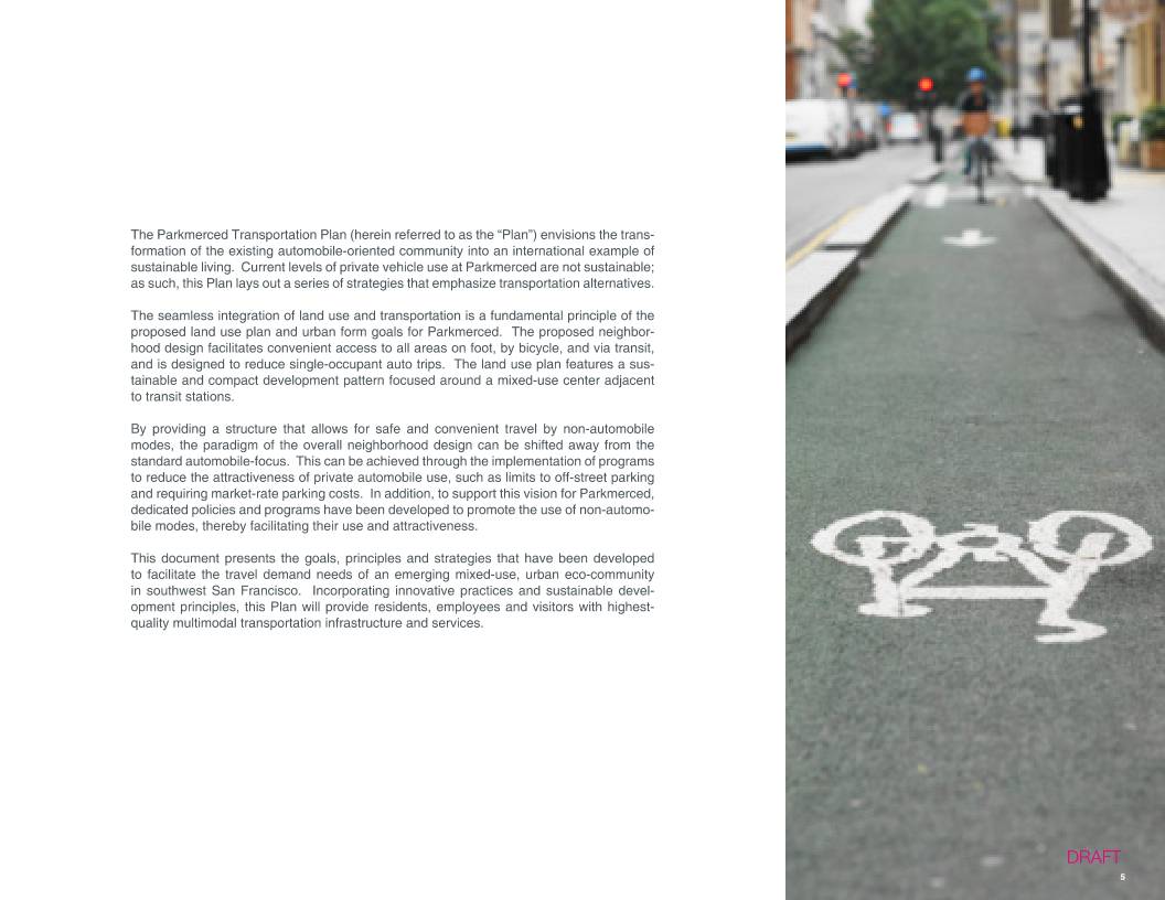
 WMS仓库系统